
Alternative Tokyo Bay Area
The metropolis of Tokyo has undergone tremendous transformations. From the modernization following the Meiji Restoration in 1868, to the Great Kanto Earthquake of 1923, and the development of the Metropolitan Expressway in preparation for the 1964 Tokyo Olympics, it has gone through numerous phases to reach its current form.
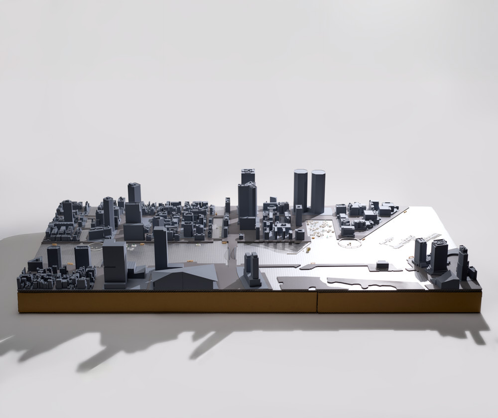
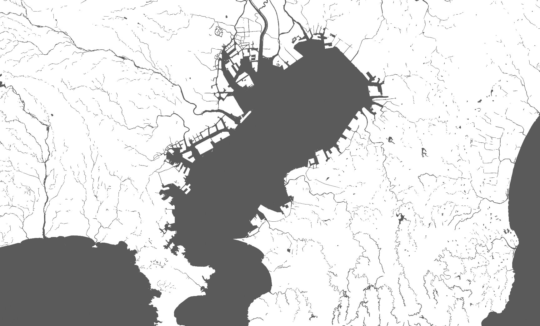
In parallel with the development of this land, coastal development and land reclamation in Tokyo Bay have progressed against a backdrop of multiple factors. Firstly, the "securing of residential land" due to rapid urban growth and population concentration. Secondly, the "increasing demand for land" for industrial sites, logistics, and container terminals. Thirdly, the "securing of disposal sites" for waste (incinerator ash and sludge) discharged from the city center. Furthermore, the "dredging" and sediment processing cycle to maintain port functions has expanded new land. As a result, the landscape around Tsukudajima, which in the Edo period was home to fishing villages, seaweed farming, and life on the water, has now been transformed into an "artificial coastline" lined with large-scale reclaimed land and skyscrapers.
Regarding these challenges unique to Tokyo, Kenzo Tange once said:Tokyo Plan 1960Kisho Kurokawa said,Tokyo Plan 2025They proposed this idea. Under the ambitious concept of "Metabolism," they projected the future onto the "empty space" of the sea. Architect Fumihiko Maki described these concepts as a completely different system built upon the image of ruins. On the other hand, architect Arata Isozaki criticized them as looking like nothing more than a linear utopia.
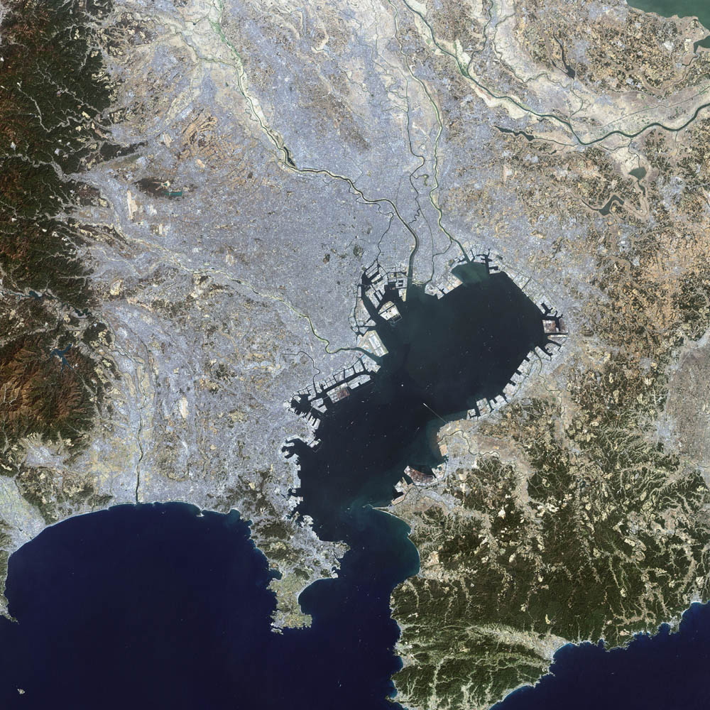
More than half a century has passed, so what is the reality of the Tokyo Bay area now? As a result of pursuing economic and functionalism, Tokyo continues to develop reclaimed land in the sea, and contrary to this physical expansion, the "sea" is drifting further and further away from our hearts.
When we re-examine the relationship between cities and the sea, what should we learn and what should we demonstrate? Functional ports and commercial bustles may be planned, but the "direct relationship between people's lives and the sea" is not depicted. With this awareness of the problem, Osore Research began research looking ahead to what Tokyo should be like in 2050. By focusing on a historical perspective and comparing it with other cities, we redefine Tokyo's inherent potential. This is a process of creating a hypothetical city, which we have named "Alternative Tokyo," starting with hypotheses such as "what if—what if...?" discovered through research and fieldwork.
1. Reclamation of Tokyo Bay and changes in tidal flats
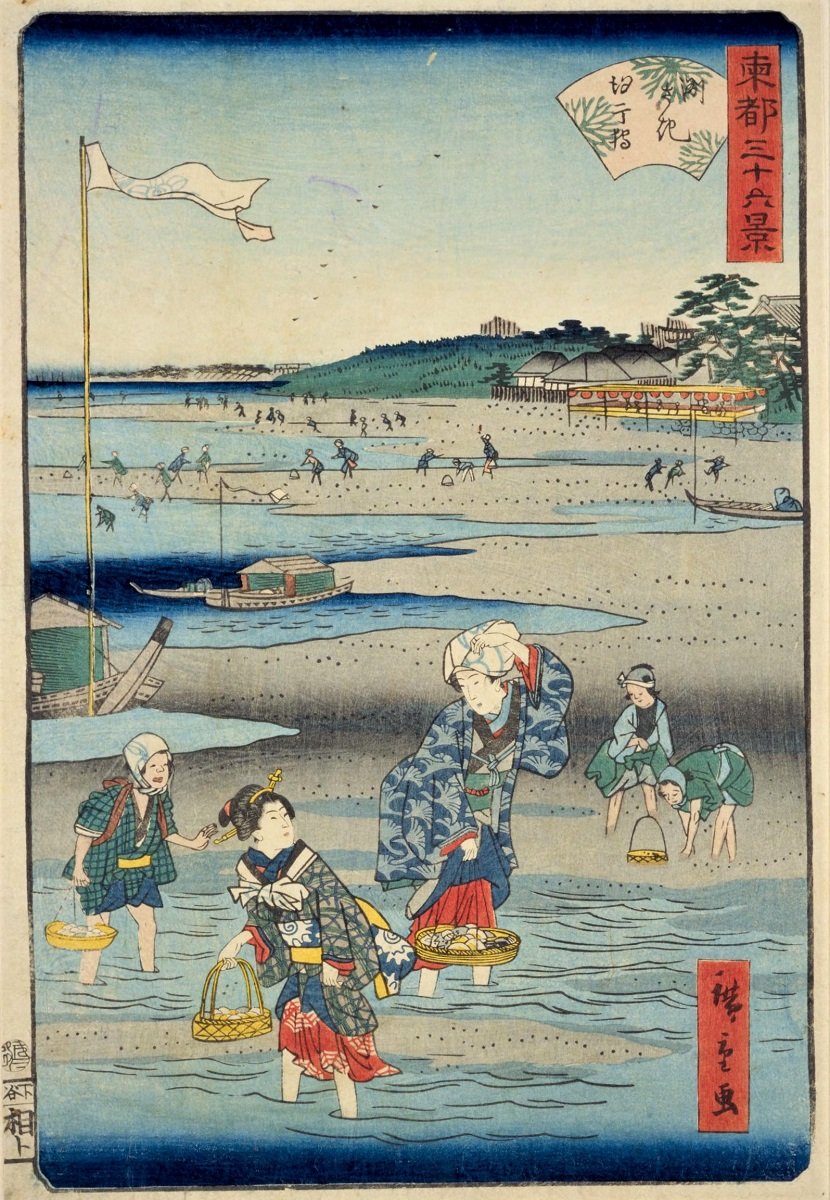
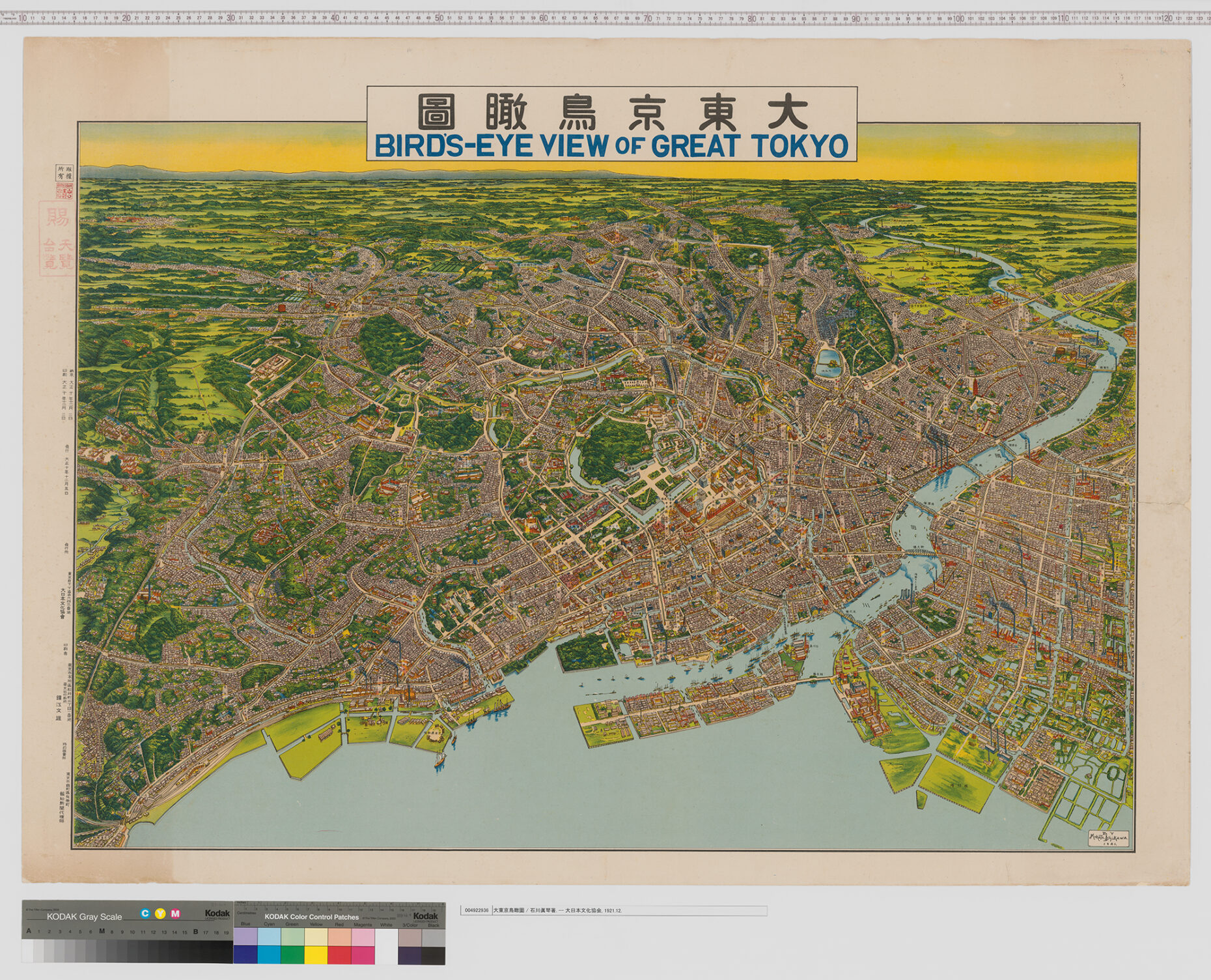
source:National Diet Library Bibliographic DataAcquired on February 23, 2026
During the Edo period, Tokyo Bay (the sea in front of Edo) had vast shallow areas and tidal flats at its innermost part. Polychaete worms and shellfish helped purify the water, and the bay played an important role as a spawning ground for fish, a place for juvenile fish to grow, and a stopover point for migratory birds.
However, during the period of rapid economic growth, approximately 90% of Tokyo Bay's coastline was artificialized, and coastal areas were reclaimed for purposes such as waste disposal and land expansion, with functional and economically driven district planning taking priority.
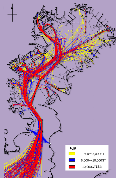
source:Kanto Regional Development Bureau, Tokyo Bay Channel Office Website
As a result, urban structures based on logistics hubs were formed, dredging became necessary to secure shipping lanes, and reclaimed land functioned as a receptacle for dredged soil. However, complex tidal flats, sandy beaches, and diverse ecosystems were lost.
The coastline, once characterized by shallow, pedestrian-friendly areas and home to a diverse array of benthic organisms and shellfish, is now lined with straight concrete seawalls, and even shallow inlets have been transformed into canals. Vertical seawalls have severed the connection between the city and the sea in many sections, limiting natural transition zones where residents can easily access the waterfront. As a result, the perceived distance between the city and the ocean has greatly increased.
Currently, while a few exceptional tidal flats remain, such as Sanbanze and Yatsu Tidal Flat, efforts are underway to restore artificial tidal flats and improve water quality, bringing back biodiversity. Tidal flat restoration is not merely an environmental protection project; it is an important issue that also contributes to disaster prevention, storm surge countermeasures, and mitigating urban temperature increases (mitigating the heat island effect).
2. Comparison with overseas cities: Differences in mindset towards containerization/landfill.
What kind of development have coastal areas in cities other than Tokyo undergone? Are there any fundamental differences between them?
Comparing development trends and systems across different cities around the world reveals differences in mindsets regarding systems and urban development (ideas concerning the right to a decent life). In contrast to waterfront development based on functionalism and economic principles, like that seen in Tokyo, cities such as London, New York, Amsterdam, and Shanghai have seen a trend of redeveloping former port and industrial areas into residential, commercial, and recreational spaces, transforming them into waterfront areas and increasing urban value when these areas became oversupplied and devalued due to the transformation of logistics and port structures (containerization). From this, I interpreted that the differences in each country's mindset towards land reclamation are reflected in their regulations.
| item | Tokyo Bay (Tokyo) | London (UK) | New York (USA) |
| Main processing method | Incineration + Landfill | Recycling + Energy Recovery | Land reclamation (transportation to other states) |
| Location of the reclaimed land | Artificial island in Tokyo Bay | Suburbs or overseas outsourcing | Other states/far away |
| Economic rationality | Creating land using incinerator ash | Tax and environmental policy advantages | Transportation costs < City construction costs |
| policy direction | Urban reuse and increased efficiency | Carbon reduction and recycling | Seeking to break away from reliance on the suburbs |
| Environmental load | Low (high temperature incineration) | Low (mainly recycling) | High (transportation/landfill) |
Therefore, we conducted research on waste disposal methods and economic rationality in Tokyo, London, and New York, and found that in London and New York, the right of urban dwellers to live in rich waterfront spaces is respected through institutional guidance that restricts landfill or directs it to rural areas rather than urban ones.
3. General city models and the somewhat unique Tokyo model
Comparing the volume of goods and ports in New York, Paris, Shanghai, Amsterdam, London, and Tokyo reveals that Tokyo has a somewhat unique structure that differs from typical urban models.
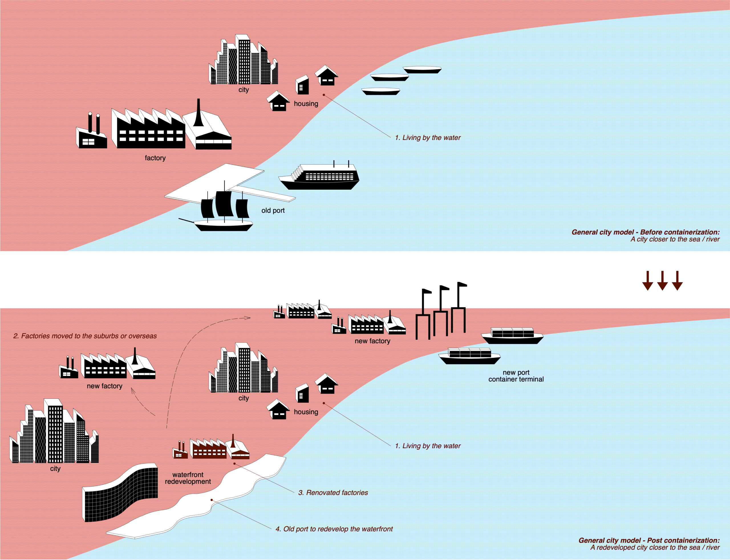
<Before containerization: Living near the water>
1. Life by the Sea
<Post-Containerization Era: Cities Redeveloped to Adhere to Waterfronts>
2. Relocate factories to suburbs or overseas.
3. Former factories and warehouses that are renovated and reused.
4. The old port will be redeveloped.
In typical urban models, the city's waterfront is eventually redeveloped into a space for living, commerce, and civic activities.
Before containerization, cities formed along the sea or rivers, and as they developed, port functions grew along the nearby shorelines. The proximity of cities, which were consumption centers, and ports, which were logistics hubs, led to the development of industrial areas, creating a structure where cities, ports, and industries were integrated.
Following containerization, container-compatible terminals were developed in locations away from traditional ports, and container transport became the dominant method due to lower logistics costs. Old ports ceased to serve their original purpose and were redeveloped as waterfront areas. Furthermore, industries relocated to suburbs or overseas, and former industrial zones were redeveloped alongside urban expansion.
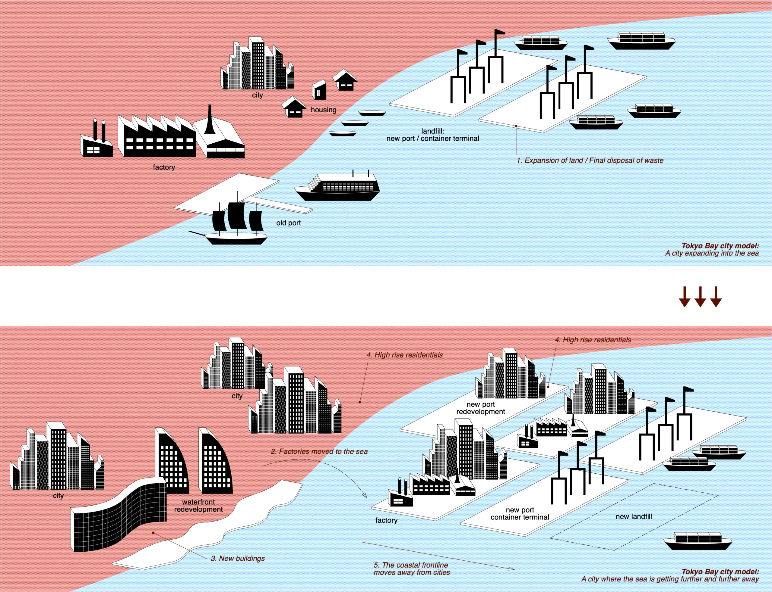
<Cities expanding into the sea>
1. Expansion of the site / Final disposal site for waste
<The sea is getting further and further away from the city>
2. Factories, warehouses, etc., will be moved to landfill sites.
3. A large, newly constructed building that will serve as a landmark.
4. High-rise apartment buildings line the coast.
5. The coastline moves away from the city.
The Tokyo model has a somewhat unique structure. It's a rational system that generates land from waste, but urban dwellers are gradually distanced from the front lines.
Tokyo has expanded its urban area by reclaiming land from the bay, consistently placing container terminals and industrial functions on its outermost waterfront. A cycle continues where port functions are relocated to newly created reclaimed land using urban waste and dredged soil, and the former terminal sites behind them are redeveloped.
As a result, port and industrial functions were consolidated on newly developed land, and the surrounding vacant lots were converted into high-rise condominiums. It is believed that the current bay area landscape was formed through the intersection of administrative challenges such as housing supply and development based on market principles.
4. Characteristics of the Tokyo Model: Coastal Area Land Use Planning (Coastal Zoning)
In coastal areas, economic efficiency and functionality take precedence, and there is no unified urban planning that spans multiple municipalities. Nevertheless, a common feature of the Tokyo Bay area is that the first row facing the sea is an industrial zone. Bay areas based on functionality and economic principles have few waterfront spaces and a sparse sense of human presence.
While the basic structure of the bay area follows a gradient from industry to commerce to semi-residential areas and then to residential areas, small residential areas remain in some parts of Chiba's coast and around Kachidoki and Tsukuda.
If: What if the land use zone layout was reversed?
If the first row of buildings closest to the sea had been designated as residential areas, how would the bayside landscape and urban behavior have changed? Could Tokyo Bay have been conceived not as a city prioritizing function and economy, but as a city in harmony with the sea?
5. The History of People Living on Water
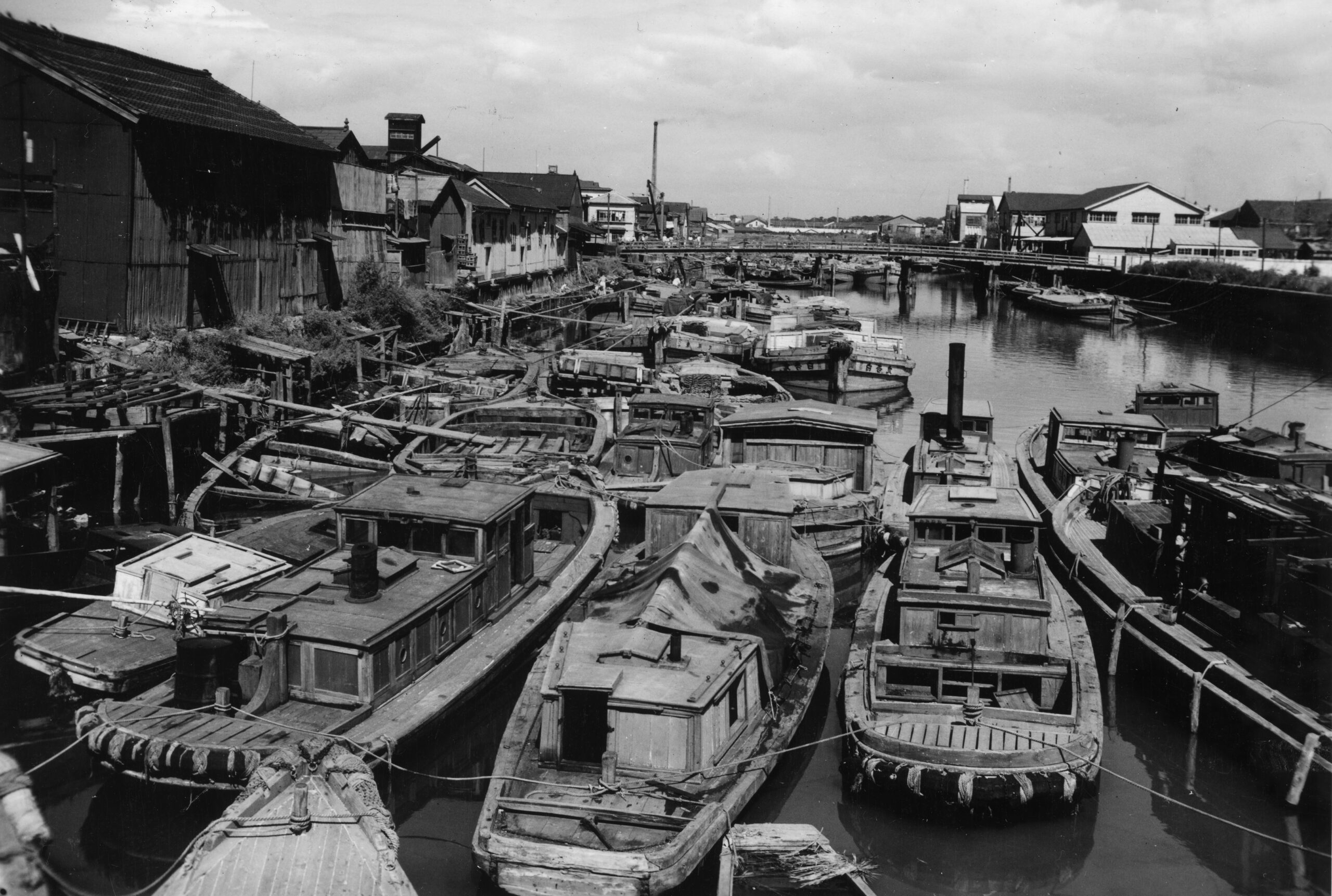
Tokyo once had a culture of people living along the waterfront. In areas like Kachidoki and Tsukuda at the mouth of the Sumida River, people made their living from fishing and lived in houseboats. They were essential workers who supported the logistics of Tokyo Bay, but economically and socially, their situation resembled that of a favela or slum. This culture was eliminated with the modernization of the city, and there was no system to register moored boats on the Sumida River or Tokyo Bay as permanent "residences," which became virtually impossible due to restrictions under the Port and Harbor Act, River Act, and Building Standards Act. The system itself wiped away a culture of a rich way of life.
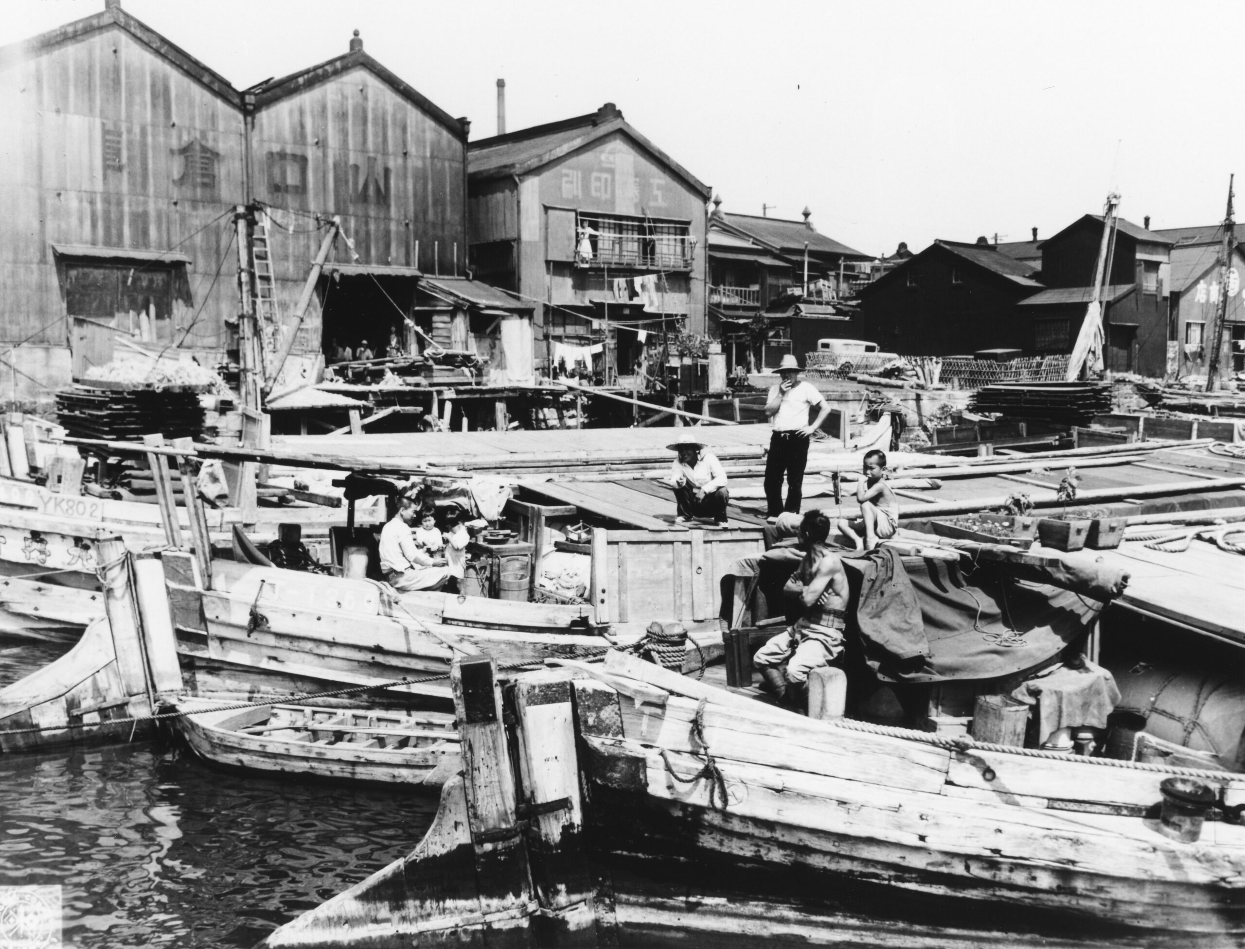
Research into floating dwellers around the world reveals that in London, Amsterdam, and Copenhagen, floating houses and houseboats are recognized by the government as permanent residences, allowing residents to register, pay taxes, and access schools and medical services. Residency requires mooring permits, meeting housing equipment standards, and permanent residency. Along the Thames River and canals, essential infrastructure such as electricity and water is readily available. In London, a significant number of people choose boat living over home ownership for economic reasons, and in Amsterdam and Copenhagen, privately owned floating houses and student housing complexes operate by renting mooring spaces from port management companies or the city. Modern floating homes are equipped with even more advanced technology, incorporating solar power, seawater heat pumps, and aerogel insulation to ensure a comfortable living environment while minimizing environmental impact by connecting to electricity and sewage systems.
If: What if the culture of people living on the water still existed?
If floating homes had been incorporated into the system as a permanent form of housing, as in Amsterdam and London, Tokyo's waterfront might have become a place where life and environmental technology intersected, rather than just a space of function and efficiency.
6. Recent Trends in Waterfront Redevelopment
In recent waterfront developments, emphasis has been placed on preparing for rising sea levels and flood risks due to global warming, preserving biodiversity, and securing recreational spaces for urban dwellers. A Chicago-based architectural design firm,"Northerly Island," a project by Studio Gang.or, a group of architects based in Rotterdam,Sea level rise catalog created by MVRDVIn recent years, however, there has been a trend towards creating "ecosystem chains" by locating nature parks and waterfront spaces on the seaward side, and by creating topographical cross-sections that change gradually from the high ground to the sea surface, thereby sequentially arranging different vegetation and biological communities in accordance with tidal levels and water level differences.
In addition, there is the design by Snøhetta, an architectural firm based in Oslo, Norway.Oslo Opera House> and public parks designed by Heatherwick StudiosLittle Island>, developed by marine architecture studio MAST <Land on WaterExamples of building types developed as cultural, commercial, and recreational facilities for urban dwellers can be seen on waterfronts around the world.
7. Rights to live in Japan and around the world
A comparison of regulations across cities reveals that in Japan, many regulations are based on functionality and economic principles, and cannot be said to guarantee a richness of human activity. In contrast, in Europe and the United States, there are provisions that guarantee the "right to live" in public and residential spaces, and these serve as tools to shape the specific living environment at the design stage. For example, in London, the minimum required outdoor space for residential facilities is set at 5 square meters per bedroom plus 1 square meter per person, while in Australia and the Netherlands, even the area and depth of balconies and private gardens are regulated. In France, Germany, and Canada, standards are sometimes determined at the municipal level, but the securing of public and private outdoor spaces influences design practices.
This stems from the fact that in Europe and the United States, there is a culture of ownership and a sense of right to public spaces, whereas in Japan, there is a deeply ingrained feeling that public spaces are "provided by local governments." Osori Research believes that even a simple single clause could change this perception, and that by mandating environmental contributions to public spaces for developments above a certain scale, it may be possible to reconcile development with the natural environment and citizens' rights.
8. Understanding the essence of the city through reality and imagination
There are two books that offer clues to thinking about the relationship between cities and people, and that deepen the insights into urban research and design.Spatial Anthropology of TokyoIn "(Chikuma Shobo)", the author historically and geographically deciphers Edo's rich waterside culture through concrete examples where urban space and citizens' lives are closely intertwined, such as water buses that toured Edo's downtown area and plazas at the foot of bridges (hirokoji and hashizume). On the other hand, Italo Calvino'sInvisible CityIn "The City of Imaginary Things" (Kawade Shobo Shinsha), the traveler Marco Polo recounts imaginary cities to the former emperor Kublai Khan, demonstrating that cities reflect human memory, desires, and the complexities of society.
What both authors have in common is the perspective that a city is not merely a physical structure, but a place that reflects people's lives, culture, and values. However, their methods differ: Jinnai takes an academic approach that analyzes historical and realistic urban examples, while Calvino philosophically depicts the essence of the city through literary imagination.
*References
Shigeo Okamoto (photographs), Yoshikichi Suzuki (eds.), "Immortal Architecture 4: Itsukushima Shrine: Hiroshima, Itsukushima Shrine," Mainichi Shimbun, 1988.
"The River," written and illustrated by Kakuko Sato, Fukuinkan Shoten, 1966.
Rem Koolhaas and Hans-Ulrich Obrist, "PROJECT JAPAN: Metabolism Talks…", TASCHEN, 2011.
THE ANATOMY OF SABKHAS by Rashid bin Shabib Rizzoli 2021
Think the Earth, "The Blue Star and the Blue Sea," Kinokuniya Shoten, 2024.
"BLUE OCEAN DOME: Let's Talk to the Sea," by Kenya Hara and Hara Design Institute, Japan Design Center. Zeri Japan, 2025.
Takeshi Sasaki, "Japan's Marine Resources: Why the World is Paying Attention," Shodensha, 2014.
Masanobu Shibuya, "Protecting the Life of the Sea: A Professional Diver's Dream," Shunjusha, 2014.
Marc Levinson et al., "The Container Story: How the Invention of the 'Box' Changed the World" (Revised and Expanded Edition), Nikkei BP, 2019.
Paul Hawken (ed.), et al., *Regeneration: Ending the Climate Crisis in This Generation*, Yama-kei Publishers, 2022.
Paul Hawken (ed.), et al., *Drawdown: 100 Ways to Reverse Global Warming*, Yama-kei Publishers, 2021.
Moritaka Nishihira, "Ecology of Scaffolding (Series: Ecology of Symbiosis, Vol. 8)," Heibonsha, 1996.
Mike Hansell et al., "The Animals That Build: From Beaver Floating Houses to Termite Skyscrapers," Seidosha, 2009.
Akio Azeyanagi, "Sea Architecture: Why Build It? How Has It Been Built? (Culture and Urban Development Series)," Suiyosha, 2021.
Takashi Hasegawa, "The Architecture of Living Things," Heibonsha, 1981.
Anna Aslaug Lund, Ole Fryd & Gertrud Jørgensen, Urban Shores – Towards Landscape-Based Coastal Adaptation, Danish Architectural Press 2025
"Oceans of Life," Vogue Portugal, 2025.
Italo Calvino, *Invisible Cities*, Kawade Shobo Shinsha, 2003.
Fumihiko Maki, "The City That Appears and Disappears," Kajima Publishing Co., 1980.

Regarding the issues revealed in the research, such as land reclamation, shoreline zoning, waterfront living culture, and waterfront space development, if there are areas that barely remain as residential areas, it may be possible to test various hypotheses about the rich culture and rights of waterfront living in the bay area. Therefore, Osore Research and Minato Lab visited various locations in the Tsukiji, Kachidoki, and Tsukuda area, which in the Edo period was known as "Edomae, the Water City," with many boats coming and going and townspeople bustling about, to experience firsthand the main elements of the research, such as the utilization of artificial tidal flats and reclaimed land.
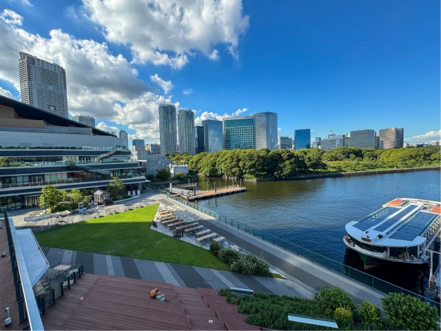
1. Waters Takeshiba
This waterfront complex opened in 2020 in a coastal area near Hamamatsucho Station. It aims to restore an ecosystem similar to that of the Edo-mae Sea, and is developing tidal flats. With the goal of creating a continuous environment where diverse creatures can thrive, schools, research institutions, citizens, and the government are collaborating to create a model case for the regeneration of Tokyo Bay. (photo: Photo AC)
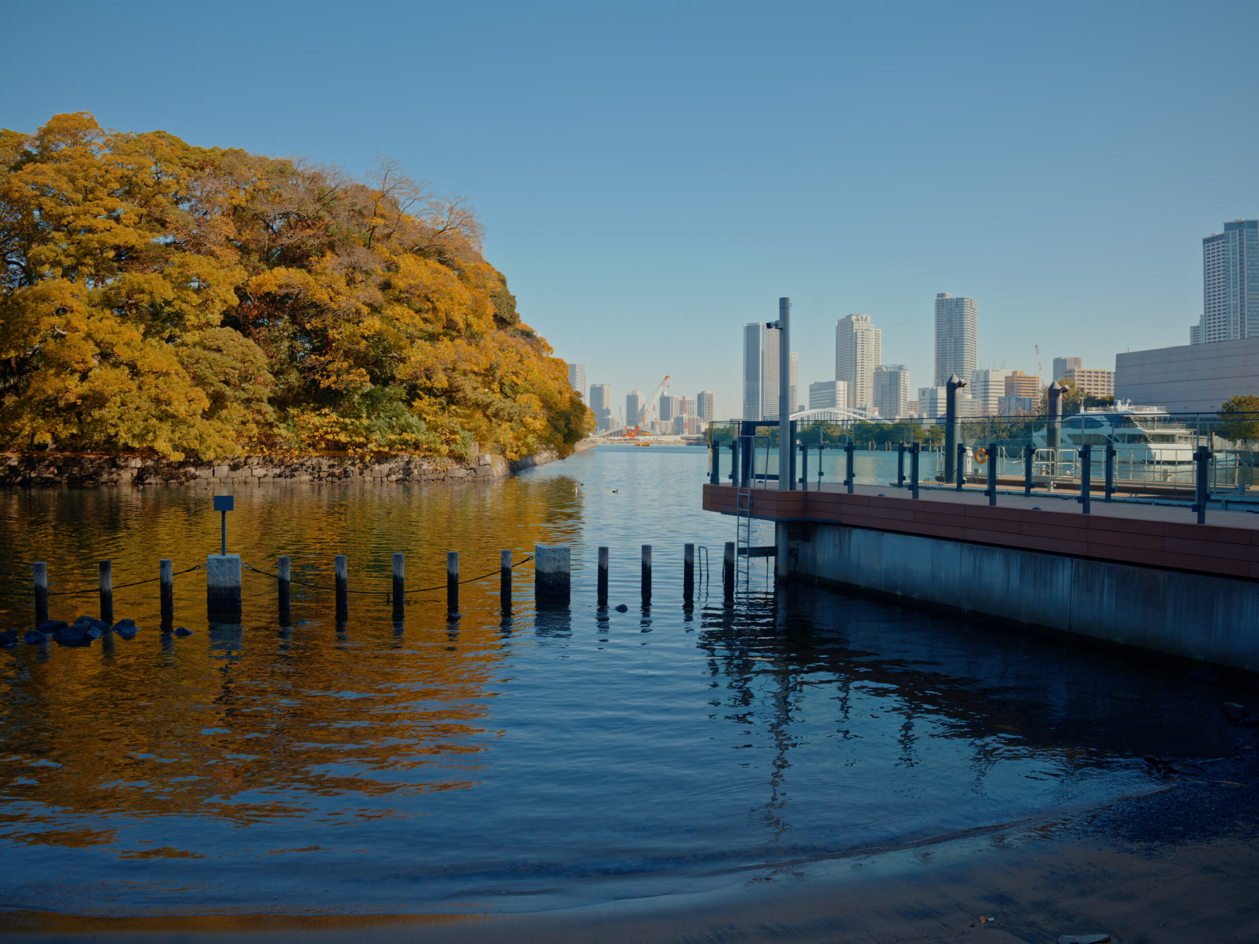
2. Takeshiba Tidal Flat
At the Takeshiba tidal flat located within the Waters Takeshiba complex, efforts are underway to restore the lost tidal flat environment by regenerating salt marshes and coastal vegetation using native Tokyo Bay species. Tidal flats play important roles such as water purification, but more than 901 TP3T of them have been lost in Tokyo Bay due to land reclamation, making collaborative efforts for their restoration essential.
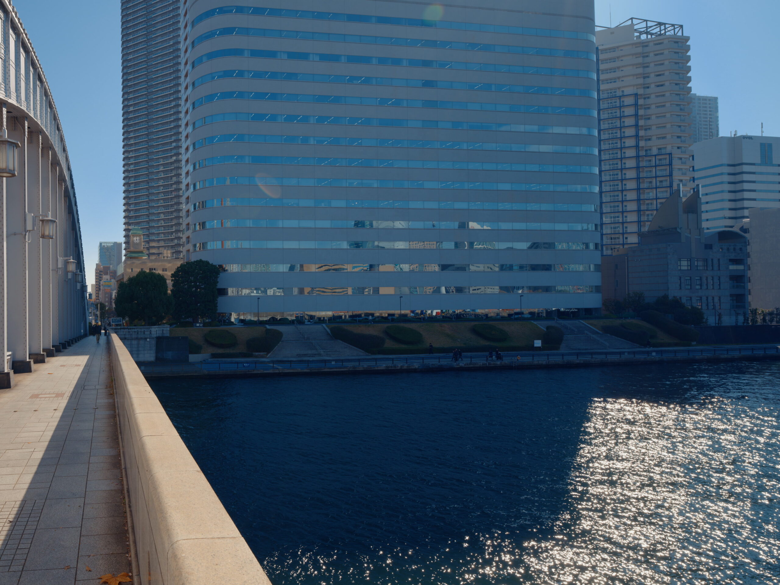
3. Kachidoki Bridge
Tsukiji and Kachidoki face each other across the Sumida River. The waterfront space beyond Kachidoki Bridge is overshadowed by the offices and apartment buildings lining the canal, resulting in poor sunlight and a lack of people using the waterfront. Kachidoki Bridge feels less like a bridge and more like an extension of reclaimed land, making it difficult to sense the presence of the sea even while walking along it. The development has focused primarily on roadways, eliminating the plaza at the bridge's end, and a grid of roads runs across the flat, artificial ground. The space that unfolds prioritizes urban functions over the context of the seaside.
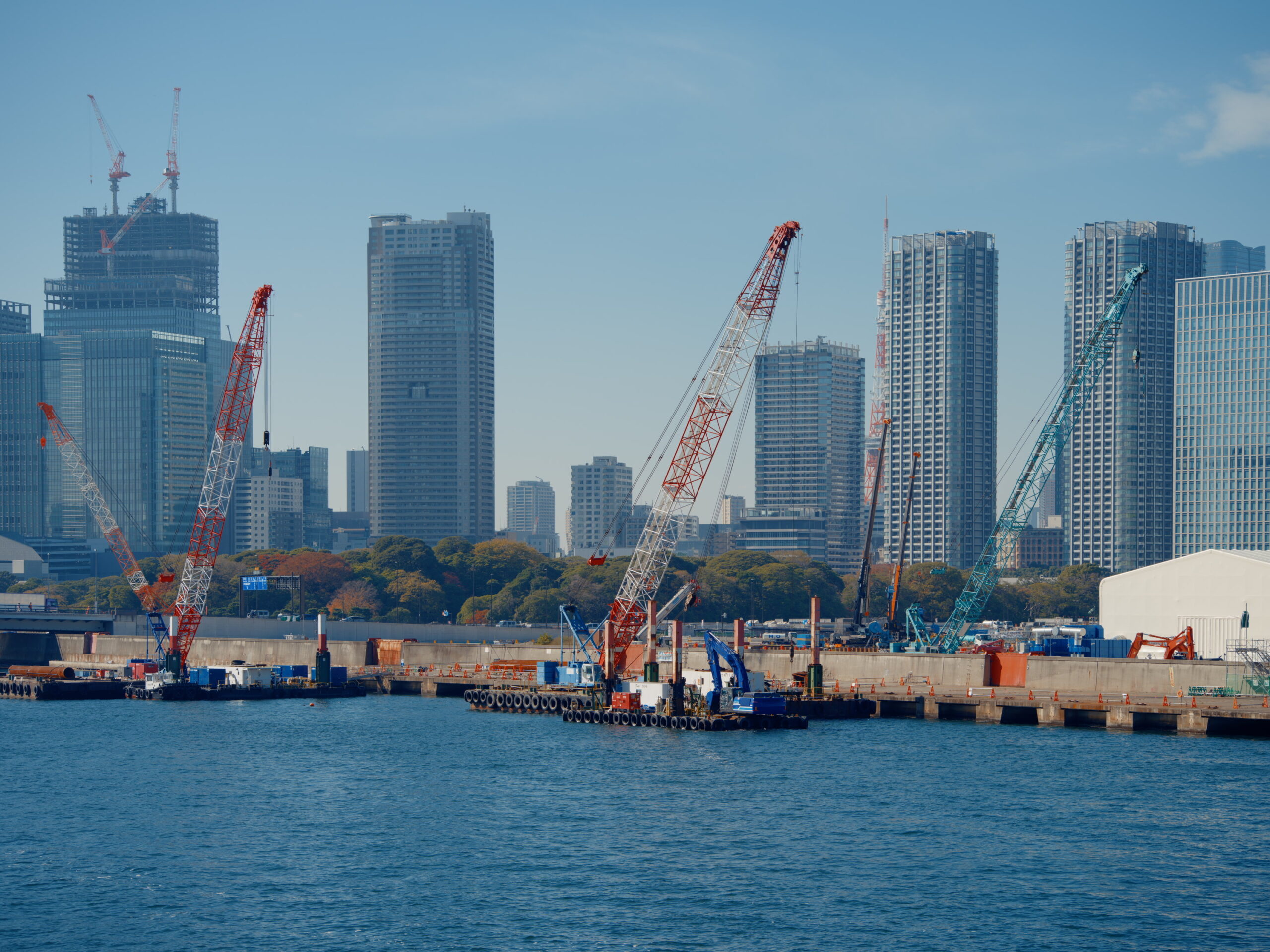
4. Tsukiji / 5. Kachidoki
The former Tsukiji Market is currently undergoing large-scale redevelopment, with plans for the construction of a multi-purpose complex and an arena. Meanwhile, Kachidoki was created as reclaimed land through dredging work in Tokyo Bay, and a ferry called the "Kachidoki Ferry" once connected it to Tsukiji. The ferry service was discontinued when the Kachidoki Bridge was completed in 1940, but before that, many boats traveled along the mouth of the Sumida River, and lively civic activities centered around the waterfront took place. It is a scene that is hard to imagine from its current appearance.
What if: What if tidal flats were developed in the Tsukiji/Kachidoki area?
To ensure sufficient sunlight reaches the tidal flats, it would be necessary to limit the height of buildings in the first one or two rows along the waterfront. If there were regulations in place that prioritized such environmental conservation, high-density land use would have been reconsidered, and abundant sunlight would have reached the waterfront spaces. As a result, a bay area that is open and coexists with the ecosystem, where many people can comfortably stay, might have been formed.
What if: What if the culture of canals and ferryboats, characteristic of "Tokyo as a Water City," had still been preserved?
Just as we see "working vehicles" in cities today, perhaps a variety of "working boats" also traversed the waters. Not only water buses and tourist boats, but also delivery boats, material transport ships, moving boats, police boats, and ambulance boats were commonplace. From the Kachidoki Bridge, one might have been able to look down on Tokyo Bay, bustling with such vessels.
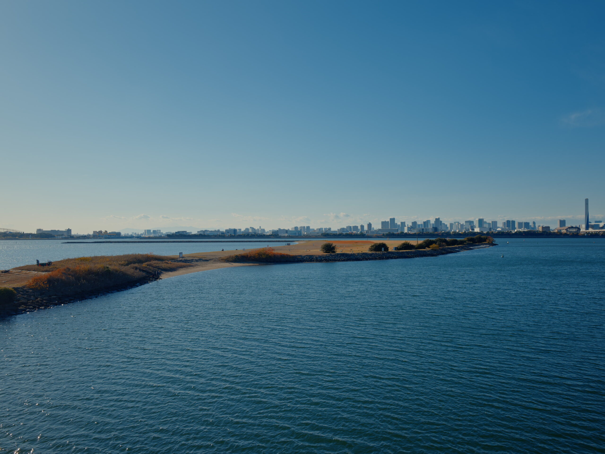
6. Kasai Seaside Park
Kasai Seaside Park features an artificial tidal flat created as part of an environmental project to restore the natural environment of Tokyo Bay, which was lost during Japan's period of rapid economic growth. By artificially restoring the tidal flat, a rich ecosystem inhabited by mudskippers, clams, and other marine life has been restored. What is particularly noteworthy is that it is being used as a place where people can interact with the tidal flat while simultaneously restoring its natural purification function. The park was developed in two separate areas: "East Nagisa," which prioritizes conservation, and "West Nagisa," which allows for waterfront use. In 2018, it was registered as Tokyo's first Ramsar Convention wetland. It is an internationally valuable model for achieving a sustainable tidal flat environment in the suburbs of a major city.
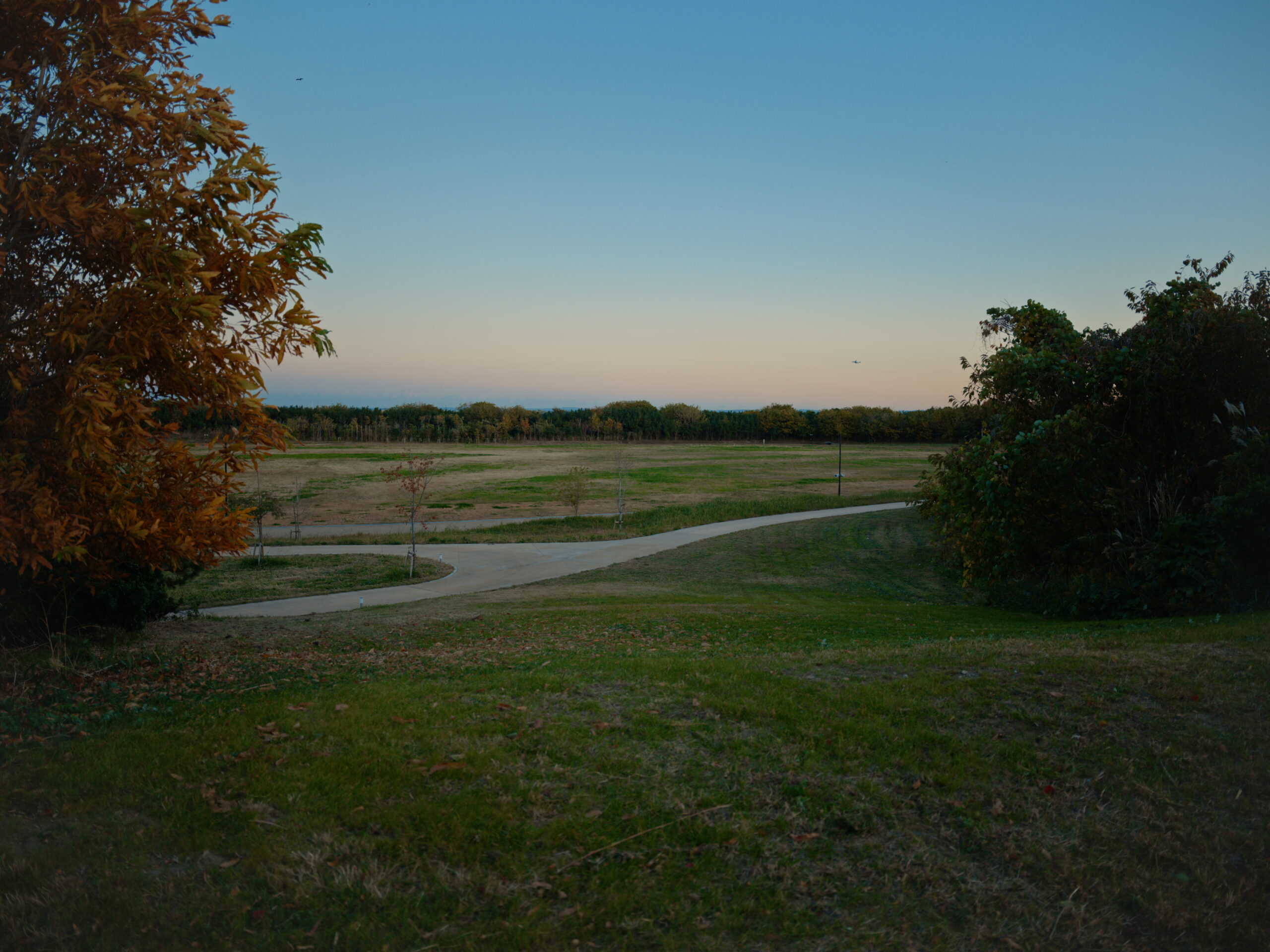
7. Umi no Mori Park
Umi-no-Mori Park opened in Koto Ward in 2025, based on the "Umi-no-Mori Project," which aims to regenerate a former landfill in Tokyo Port into a lush green forest. On the slope facing the sea, a "mille-feuille structure" (layered planting) is employed, with chinquapin and Machilus thunbergii trees, which are resistant to sea breezes and strong winds, planted in the front, and deciduous trees and tree species that serve as food for insects and birds planted in layers behind them. This creates a "windy forest" that nurtures a diverse ecosystem while mitigating the wind. In addition, by utilizing soil conditioners derived from waste and using only seedlings from the Kanto region, biodiversity is preserved while preventing disruption to the ecosystem. What was once a "mountain of garbage" is being reborn as a sustainable forest with natural cyclical functions.
What if: A Ramsar Convention-protected environmental conservation area was established at the mouth of the Sumida River?
Wild birds and diverse creatures may have returned to the rich tidal flats, and environmentally conscious waterfront spaces may have spread around them. Perhaps people were quietly connecting with nature and spending time together there. Looking through the telescope, I envisioned a landscape where humans and nature coexisted.
8. Venice (Bonus Episode)
Osori Research takes you to Venice, a unique "City of Water" in the world, where more than 100 islands floating in the Adriatic Lagoon are connected by bridges and canals. Upon arriving at Marco Polo Airport, we immediately boarded a water bus, used by locals for commuting, and disembarked in Venice from the Adriatic Sea. Through this route, we were able to experience the everyday life of the "City of Water."
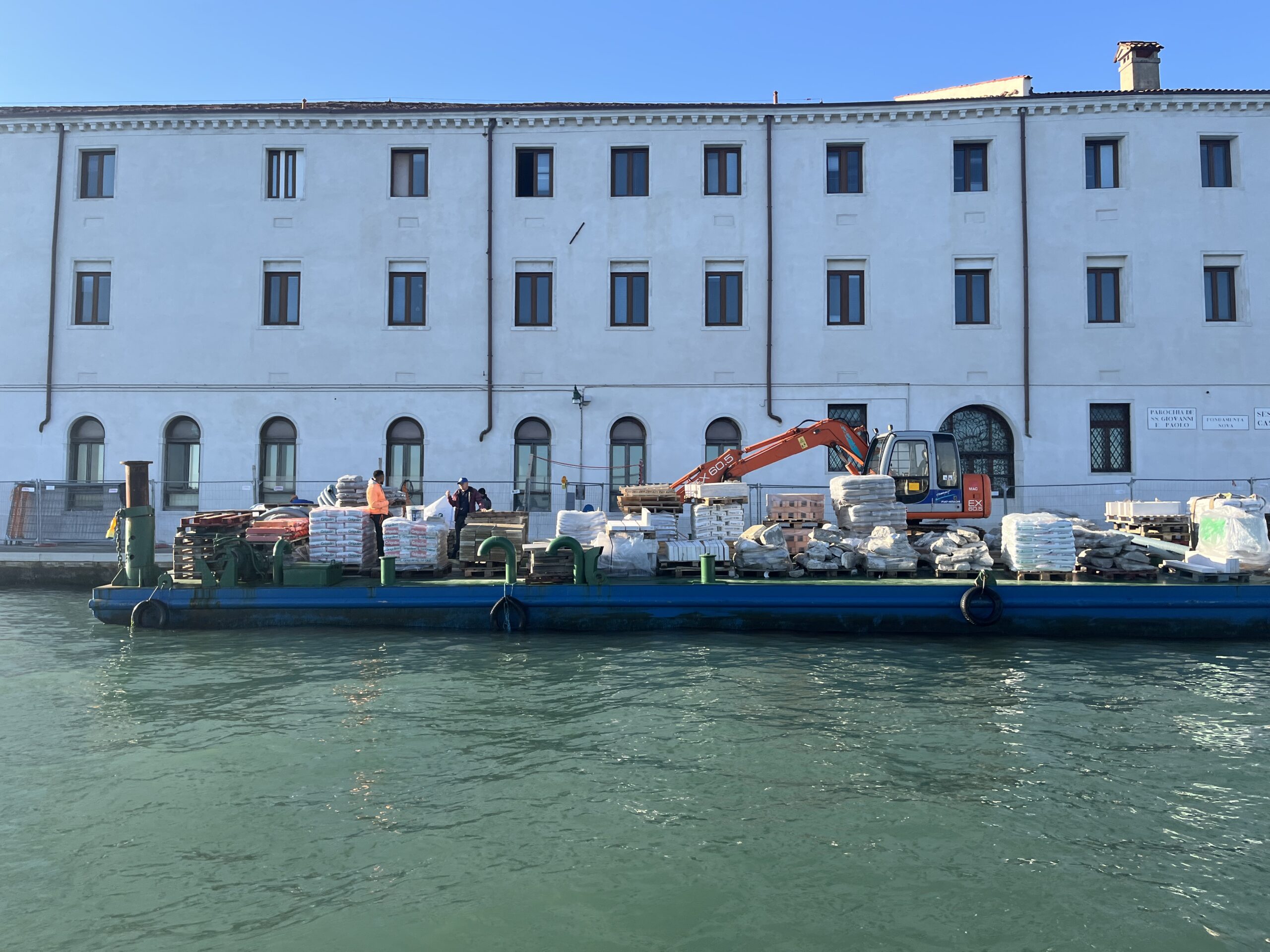
(Photo: OSO Research)
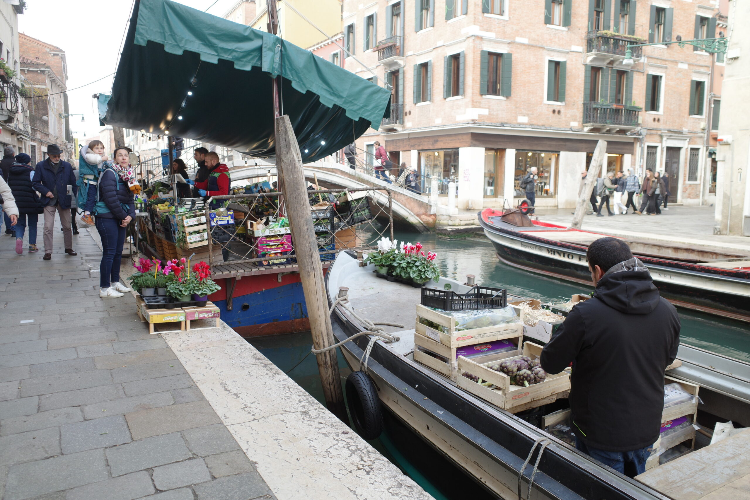
(Photo: OSO Research)
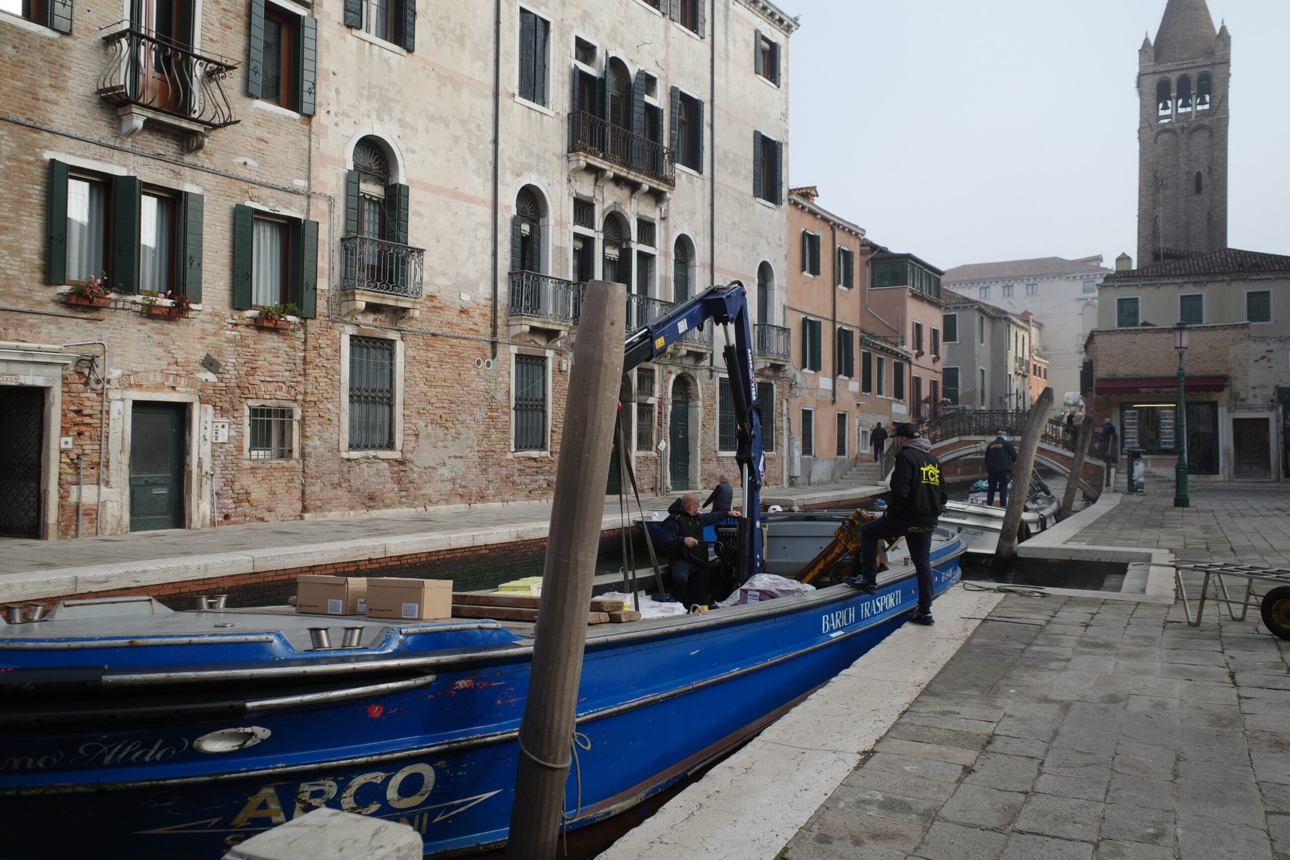
(Photo: OSO Research)
What was particularly impressive were the boats, which are the equivalent of the "working vehicles" that drive on the roads in Tokyo. Even when traveling from the mainland to the island, cars are not allowed on the island itself; visitors park in a multi-story parking garage at the island's entrance and transfer on foot or by water bus. The countless waterways and small bridges crisscross the area, and the bustling activity along the canals reminded me of the canals, bridges, and small-scale community activities of old Edo.

Critical Timeline
Through research and fieldwork, I came to believe that the cause of the various "what if" scenarios that have arisen so far—the situations that didn't turn out as expected—must lie somewhere in history. With a view to the state of the city and the sea along Tokyo Bay in 2050, I first organized the important historical events in the Kachidoki-Tsukuda area, which is the site of interest, and searched for clues for architectural proposals. Then, I set up three scenarios for creating the plan.
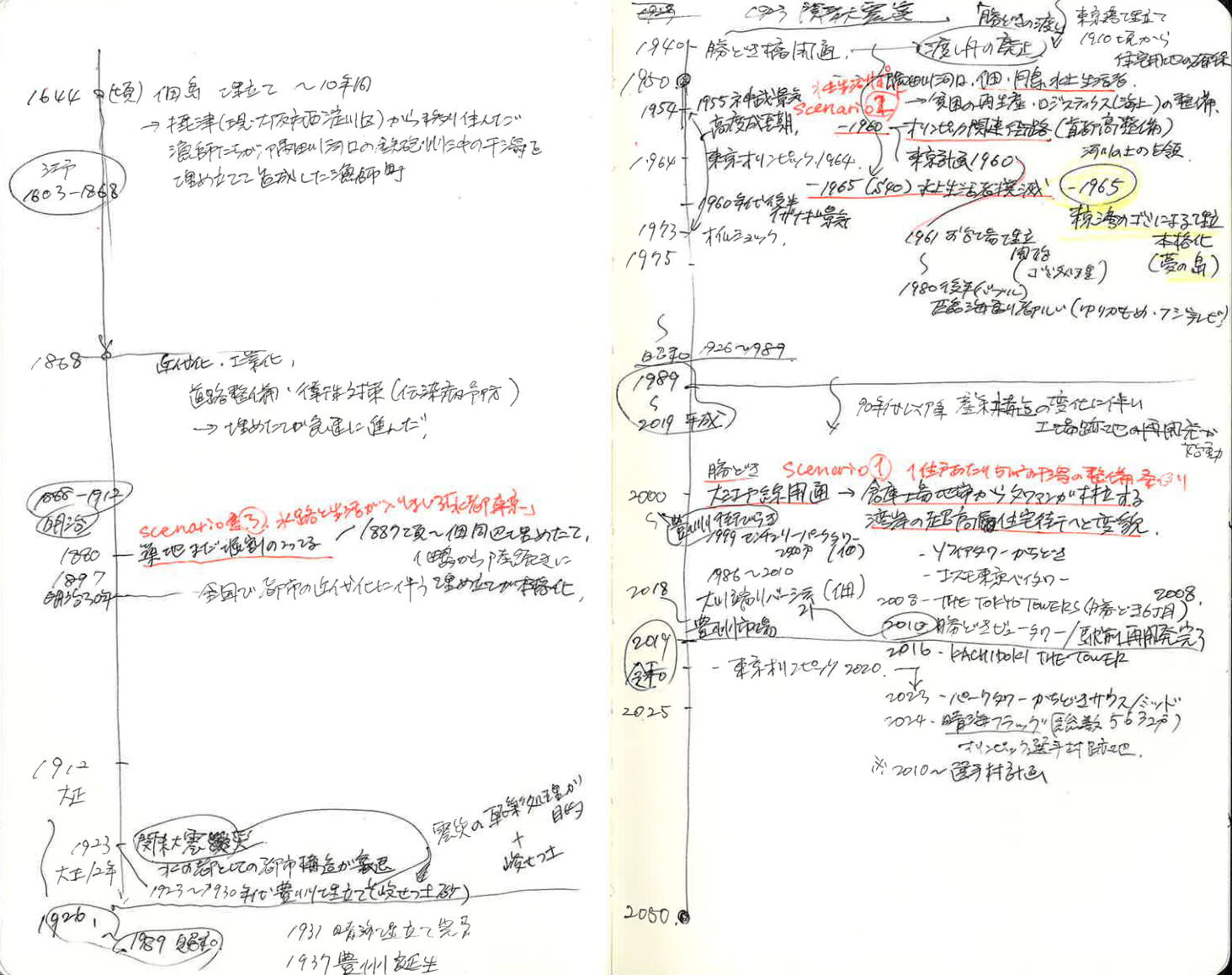
Alternative Tokyo Bay
Osori Research focused on three key starting points in a critical timeline and depicted alternative urban visions of the Tokyo Bay area from the perspective of "what if things had been different?". Through this endeavor, the aim is to highlight a variety of factors, including the mistakes Tokyo's urban history has made, important things that have been lost, and aspects of the city that are often overlooked.
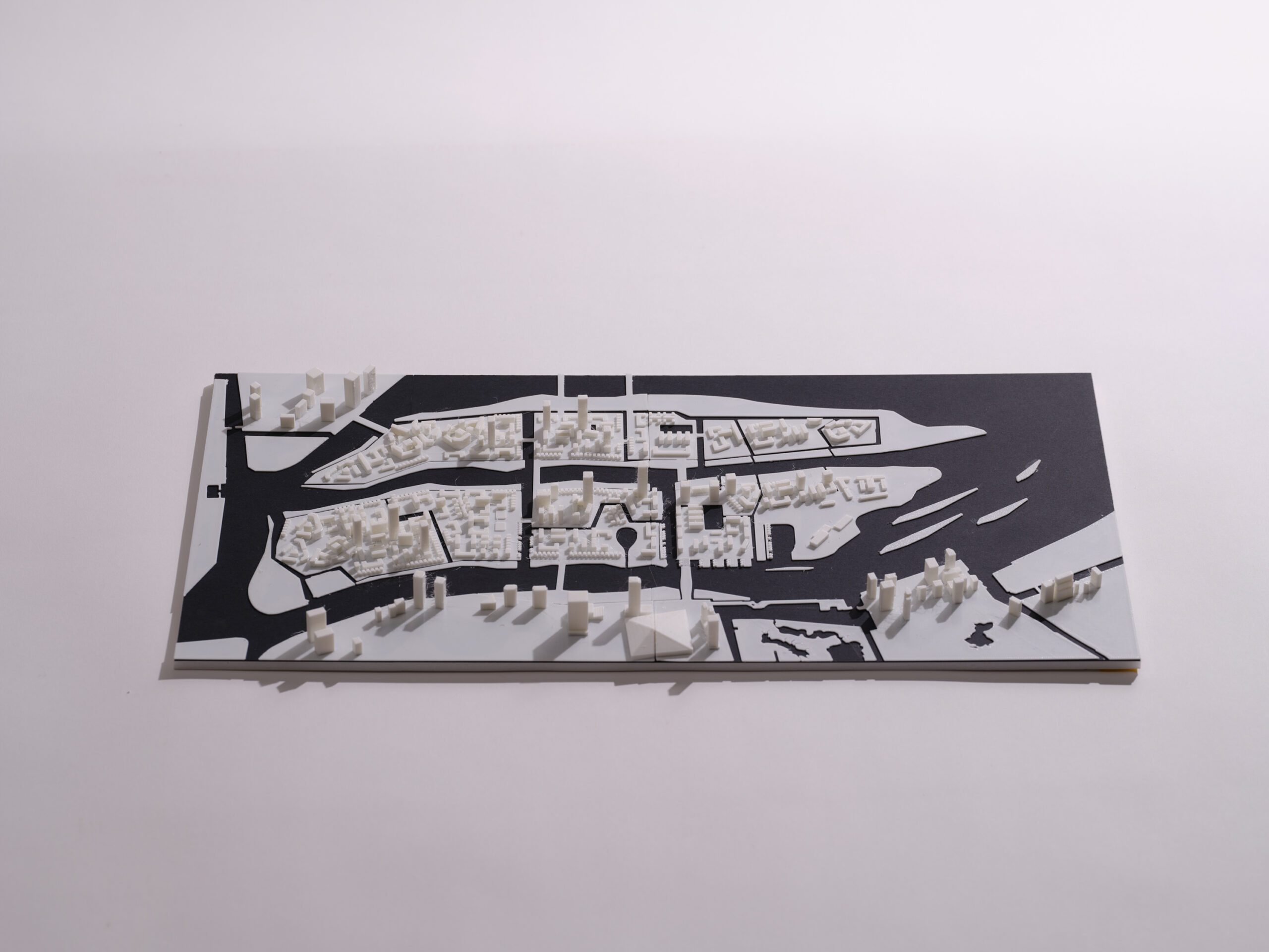
Scenario 1:
2000: Kachidoki Station on the Oedo Line opens.
→Warehouse and factory areas give way to a forest of high-rise apartment buildings.
→Transformed into a high-rise residential area along the bay.
if: If there were regulations in place to improve the environment for large-scale development
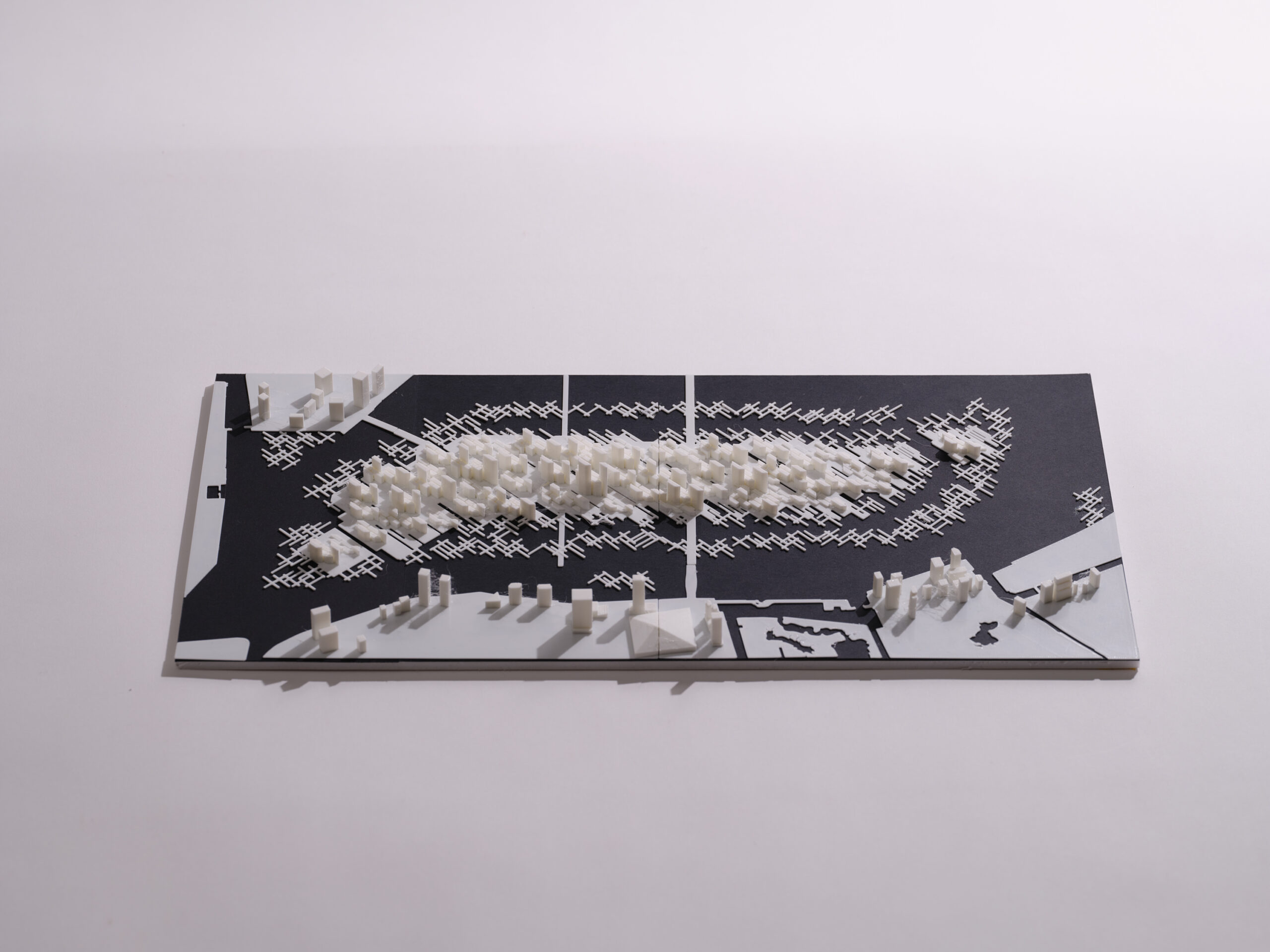
This is an example of a hypothetical Tokyo, based on the hypothesis that "what if there was a trend among Japanese people to respect the right to live in public spaces?" What would have happened if, around the time the Oedo Line extended to Kachidoki, a clause like "protecting the right to live as a citizen" had been added to the ordinance, as was done in Europe and the United States?
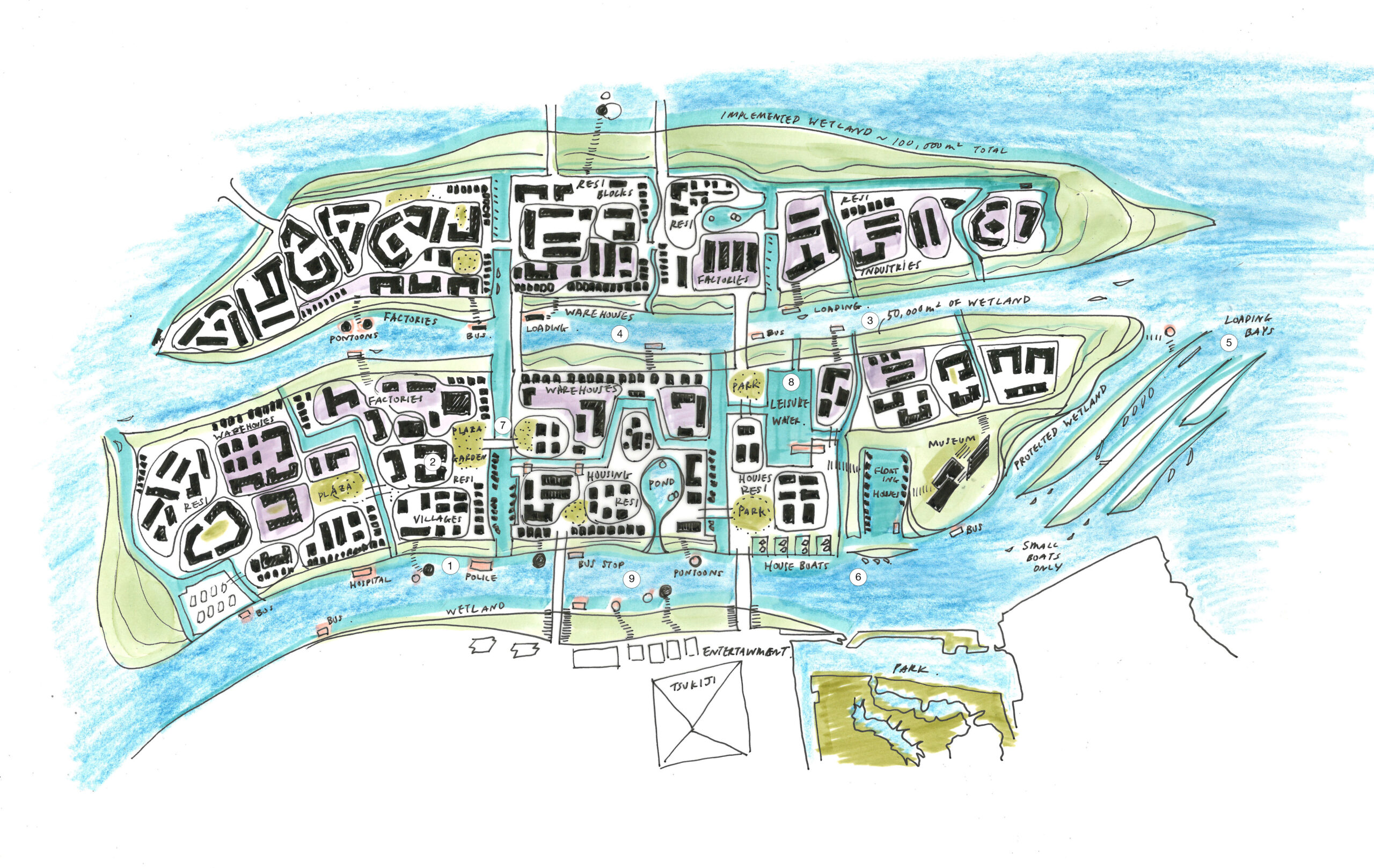
2. High-rise condominiums and large commercial facilities are located inland, from the second row onwards.
3. A 5 square meter tidal flat/waterfront space will be provided per dwelling unit.
4. Factory, warehouse, and studio facilities will be located between Kachidoki and Harumi. Access for collection and delivery will be ensured via small boats.
5. A cargo unloading area will be established. Only small boats will be able to reach the shore.
6. A landscape lined with floating houses and houseboats.
7. There is a plaza and a park at the foot of the bridge.
8. Waterfront leisure area. Training facilities for water-based sports and activities.
9. A water bus terminal, park, police station, and hospital floating gently on the surface of the sea.
For example, suppose there was an ordinance mandating the development of 5m² of tidal flats per residential unit for developments above a certain scale. If this applied to the approximately 10,000 high-rise condominiums in the Kachidoki-Tsukuda area, a total of 50,000m² of tidal flats would be developed, resulting in a tidal flat and waterfront area stretching for 1km along the coast. To preserve the tidal flat environment, the buildings in the first row along the coast would be subject to height restrictions, and the conventional high-rise condominium landscape would be shifted inland. The coastal area would then be developed with waterfront spaces, low-rise housing, commercial facilities, bridges, and wide streets, creating a vibrant waterfront.
This simple provision alone could overturn the conventional, typical land use pattern of "the first row of the coastline being an industrial zone." I have named this hypothetical ordinance the "Tokyo Bay Coast Line Design Guideline."
Scenario 2-1:
1965: Land reclamation using garbage from Tokyo Bay begins in earnest (Yumenoshima Island)
→ Eradication of people living on water
if: If the rights of those living on the water were protected
With the opening of the Kachidoki Bridge in 1940, the ferry service known as "Kachidoki no Watashi" was abolished. The water-dwelling residents of Tsukuda and Tsukishima, who had made a living fishing at the mouth of the Sumida River, were eradicated by 1965 under the guise of land reclamation expansion and modernization. As a result of urban modernization and prioritizing the economy, the water-dwelling residents were denied residency rights and the right to education, their boats were not recognized as residences, and their access to infrastructure was not legally guaranteed.
What kind of city would Tokyo have become if the culture and rights of those who live on the water had continued to be respected? A society where many people own boats as homes, docked at piers and connected to the infrastructure. Coastal areas would be formed by piers and pontoons (floating docks), and the boundaries of seawalls would have drawn an ambiguous shoreline.
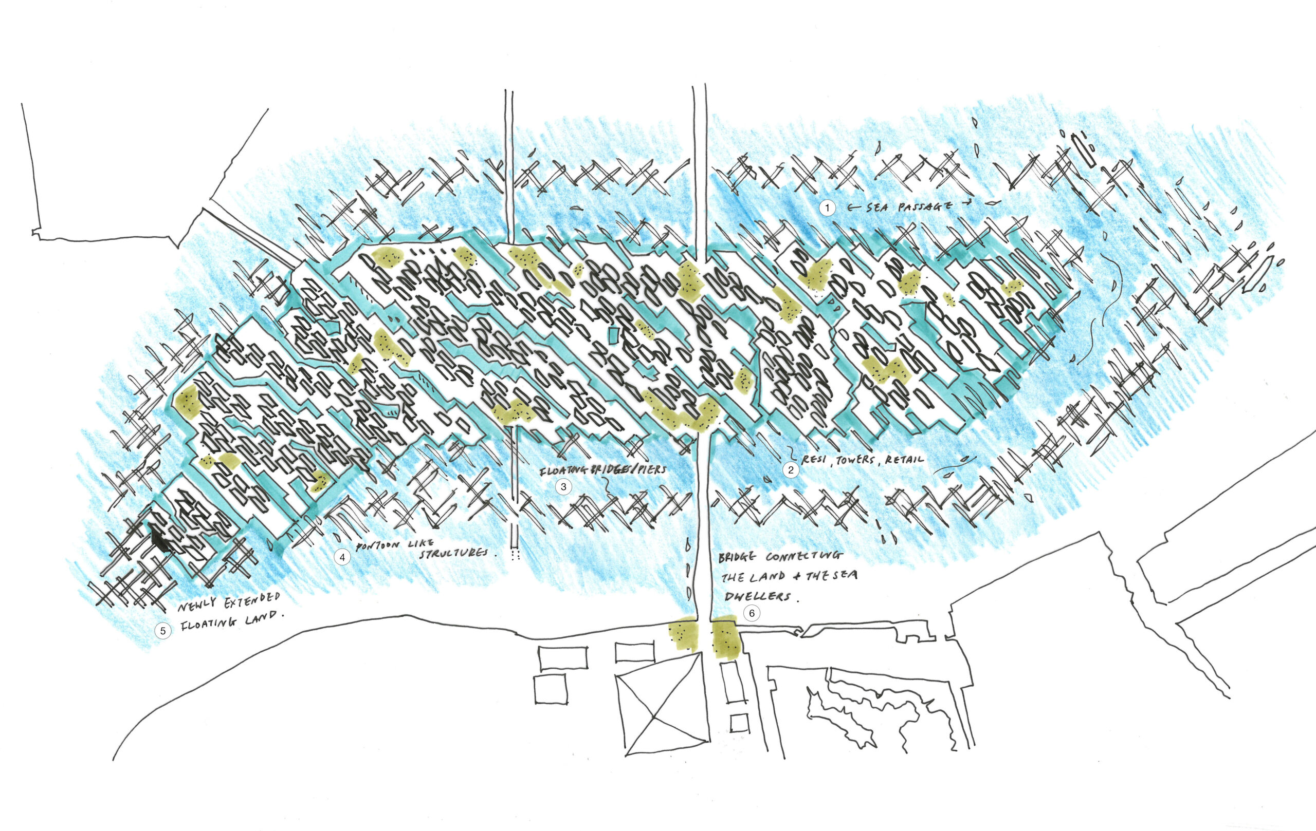
2. A floating town equipped with residences, residential towers, and commercial facilities necessary for daily life.
3. Bridges and piers.
4. A floating structure similar to a pontoon.
5. The floating site is being expanded.
6. A bridge connecting land dwellers and water dwellers.
Even if the proliferation of high-rise condominiums driven by housing demand remained unchanged, architecture might have been built on floating structures, creating a world where entrances could be accessed directly by boat.
Scenario 2-2:
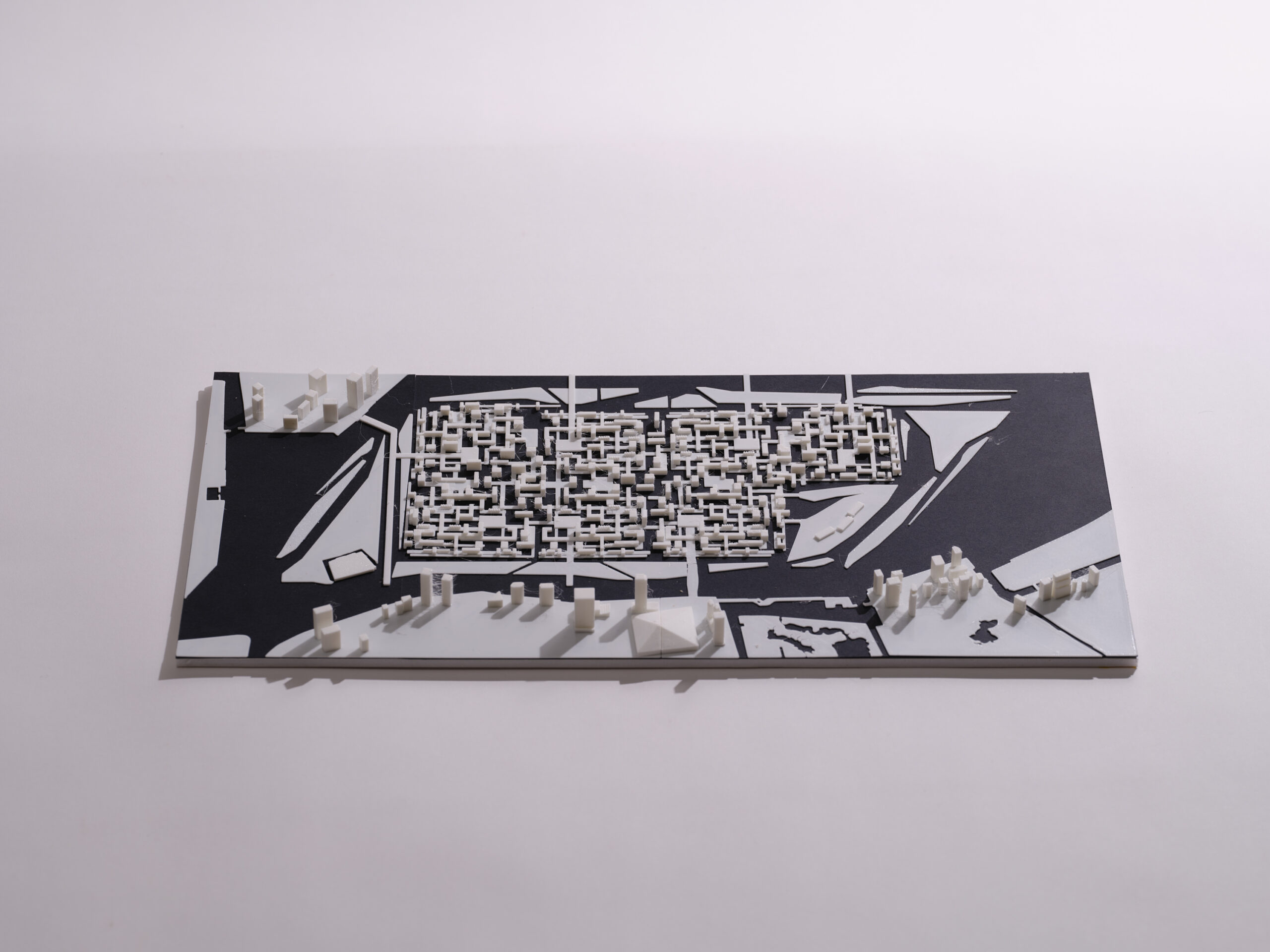
Alternatively, it's possible that the island was connected to countless small bridges, with bridgeheads and wide streets arranged around the tidal flats, creating a three-dimensional townscape that coexisted with the aquatic environment that preserved the biodiversity of Edo-era Japan.
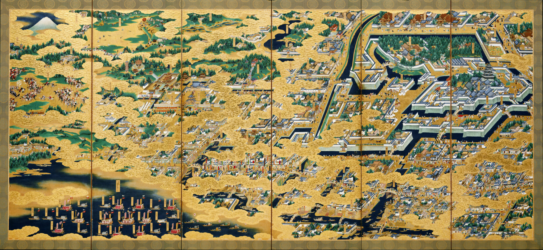
In this scenario, preserving the culture of "life by the water" gives rise to diverse architectural forms and public spaces, recreating the vibrancy of a "city of water" like Edo or Venice. The city space would have been filled with the joyful sight of people strolling along the canals, past a series of small bridges and wide streets, and alongside the workboats and shops.
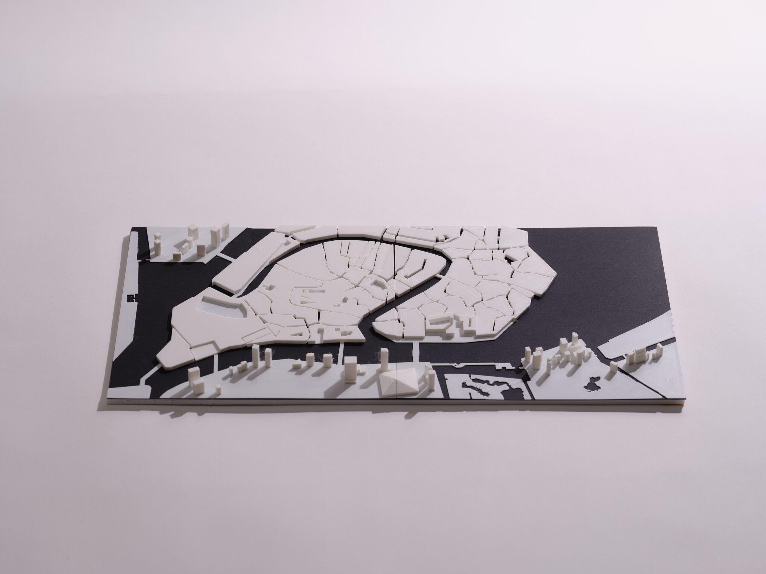
Scenario 3-1:
In 1880, with the end of the Edo period, cities underwent modernization and industrialization.
→Road construction, sanitation measures (prevention of infectious diseases), and reclamation of tidal flats were carried out rapidly.
→The canals from that time still remain in Tsukiji.
if: What if the canals hadn't been filled in, but instead used as a cultural resource?
By reinterpreting the bustling waterway network of Edo (Tokyo), where boat traffic was a daily occurrence, with that of modern Venice, a 1:1 scale Venice is inserted into the Kachidoki area. St. Mark's Square is located across from Hamarikyu Gardens, and the sunny public squares and the arrangement of major buildings fit naturally with the modern city of Tokyo. The Grand Canal flows gracefully through the center of the island, curving from the front of Tsukiji to Toyosu, with major water bus stations scattered along its course, and by following the smaller waterways, you can access anywhere by boat.
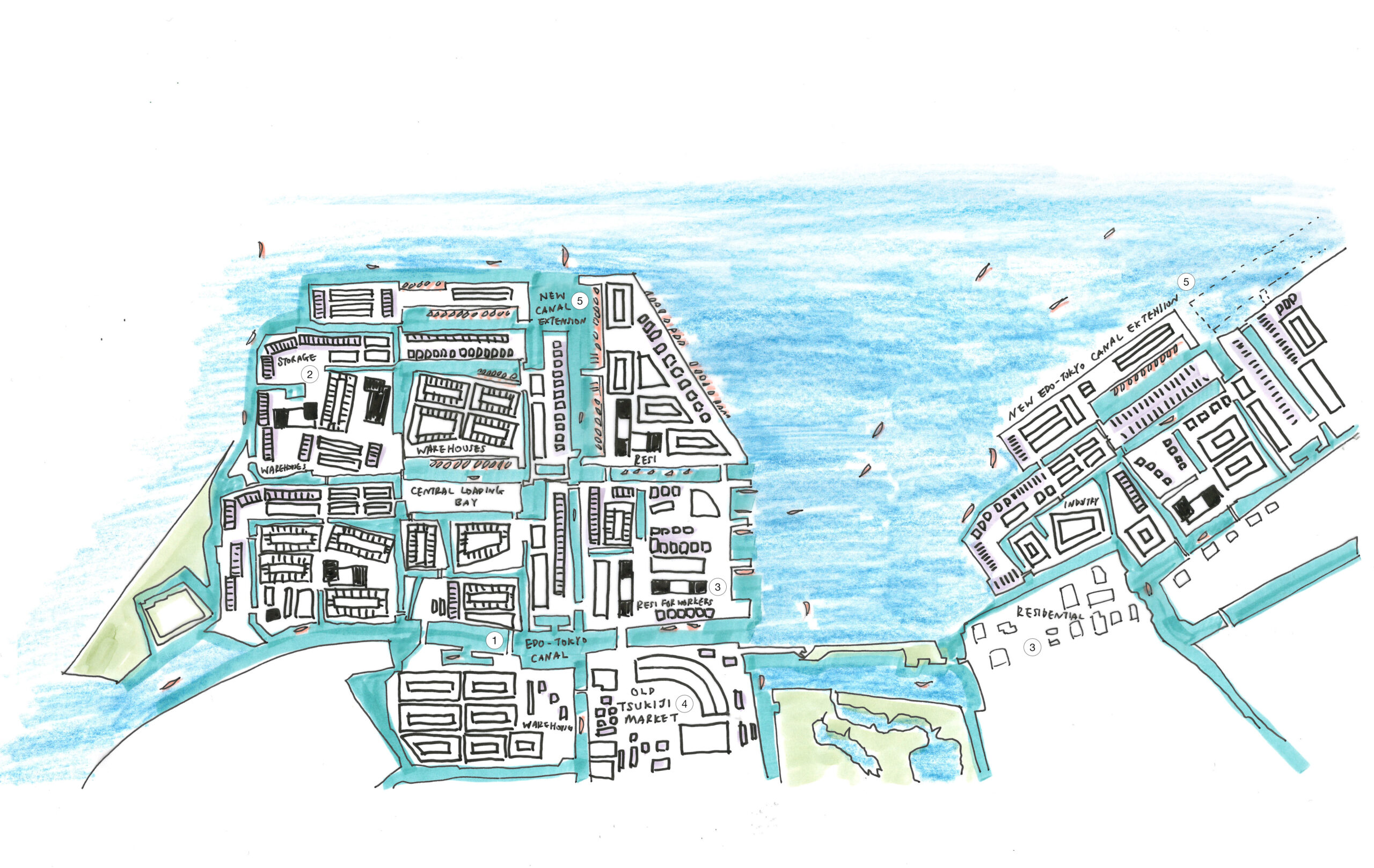
2. The layout consists of small sheds and factories lined up beyond the reclaimed land.
3. Secure housing on the premises for people working in this area.
4. The setting includes the former Tsukiji Market.
5. The trenches are extended, creating a complex layout where land and water intertwine.
With waterways so extensive, water buses became one of the main modes of public transportation, and the "Kachidoki Ferry" also continued to operate. The lively boat traffic at the mouth of the Sumida River would have created a vibrant urban landscape.
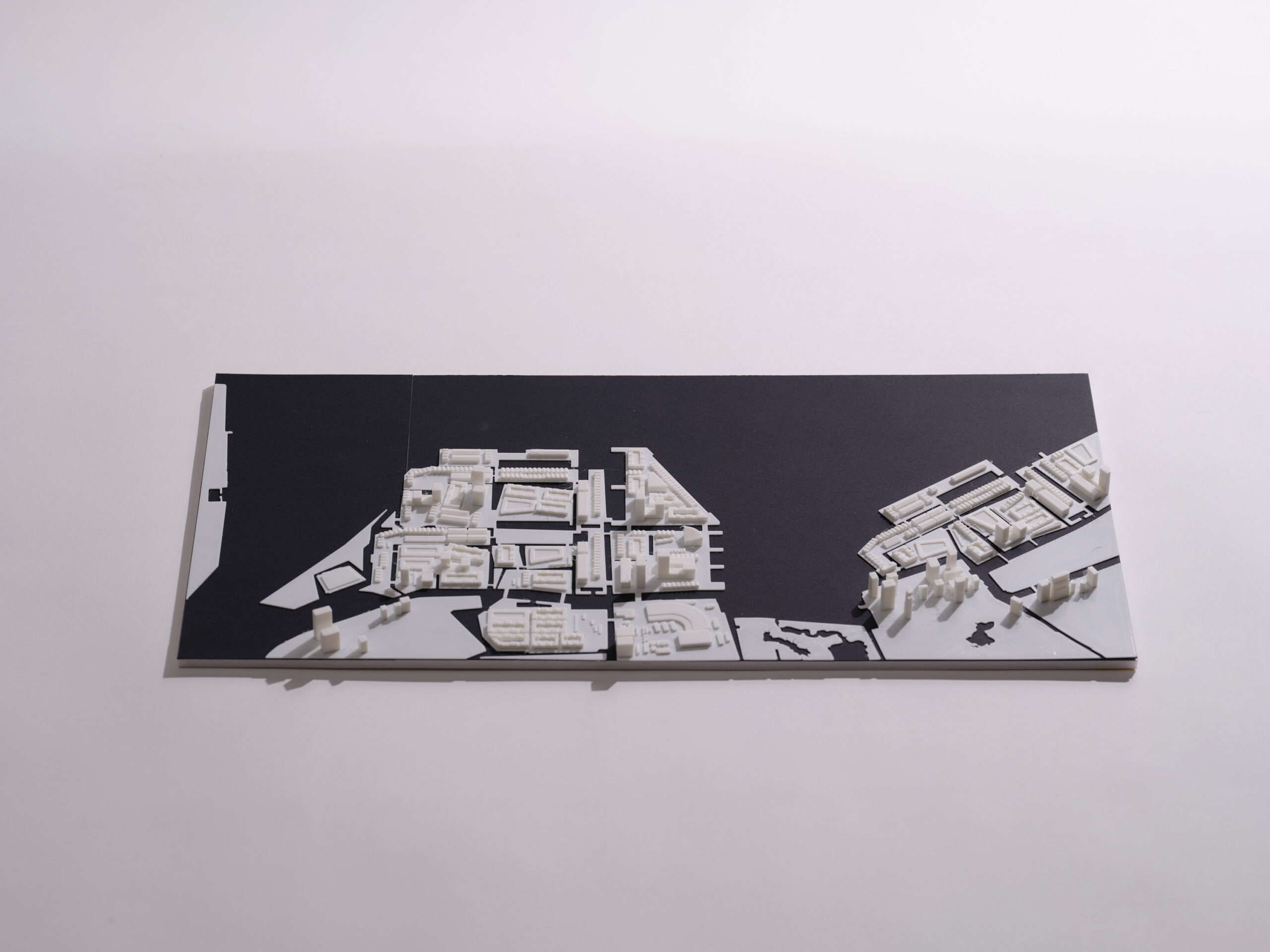
Scenario 3-2:
Alternatively, if the Tsukiji canal had remained intact to the present day, development could have involved gradually reclaiming land along the canal from the landward side, creating a series of small islands extending out into the sea. This would have resulted in an organically developing urban structure with a mix of commercial, residential, cultural facilities, and public squares within each unit. In this case, if there had been a bay providing access to the former Tsukiji market, large tributaries would have been unnecessary, the topography of the canal would have been preserved to the present day, and the landscape and urban functions of Kachidoki might have been completely different from what they are today.
Tokyo Bay Area Plan 2050
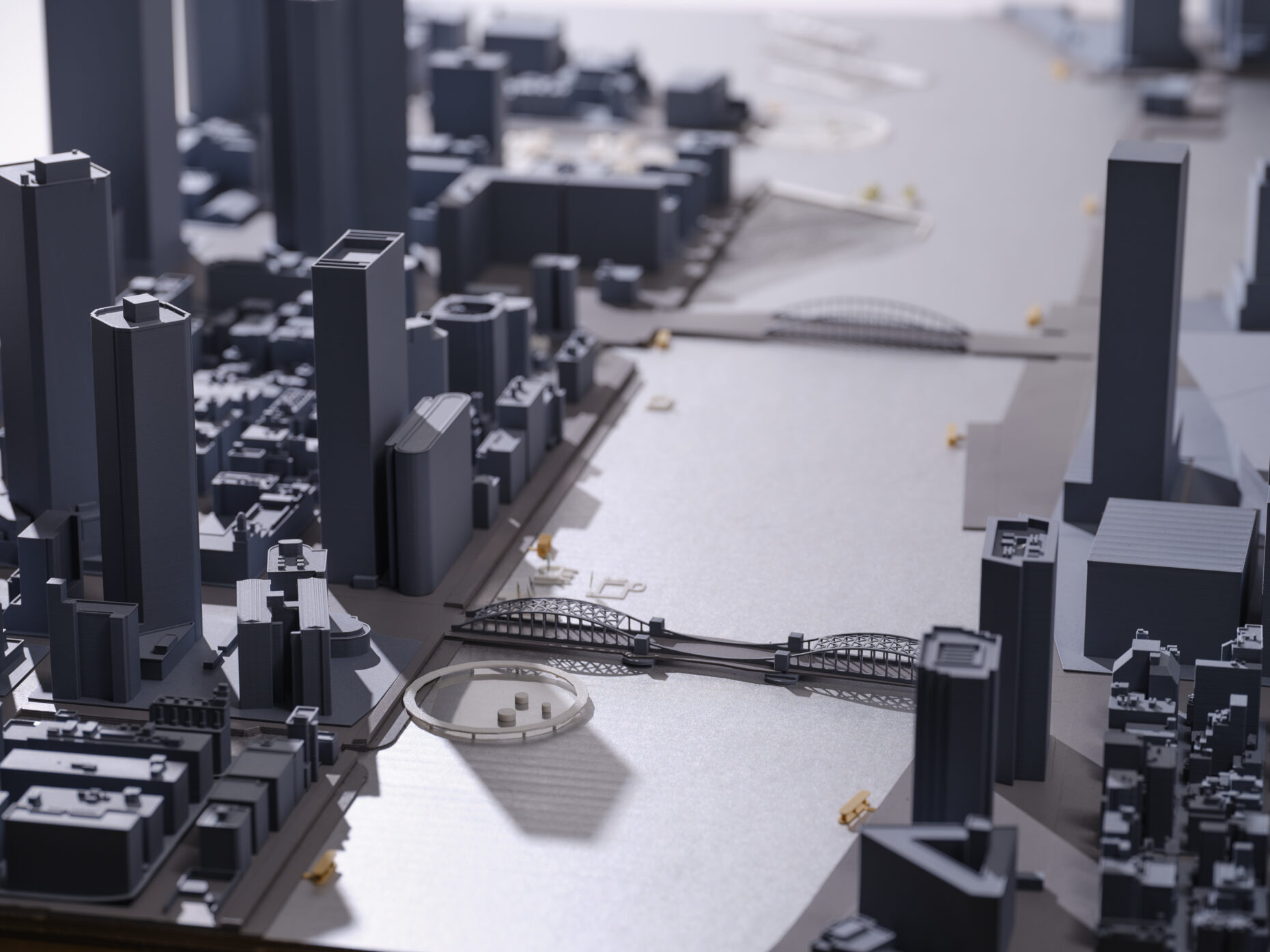
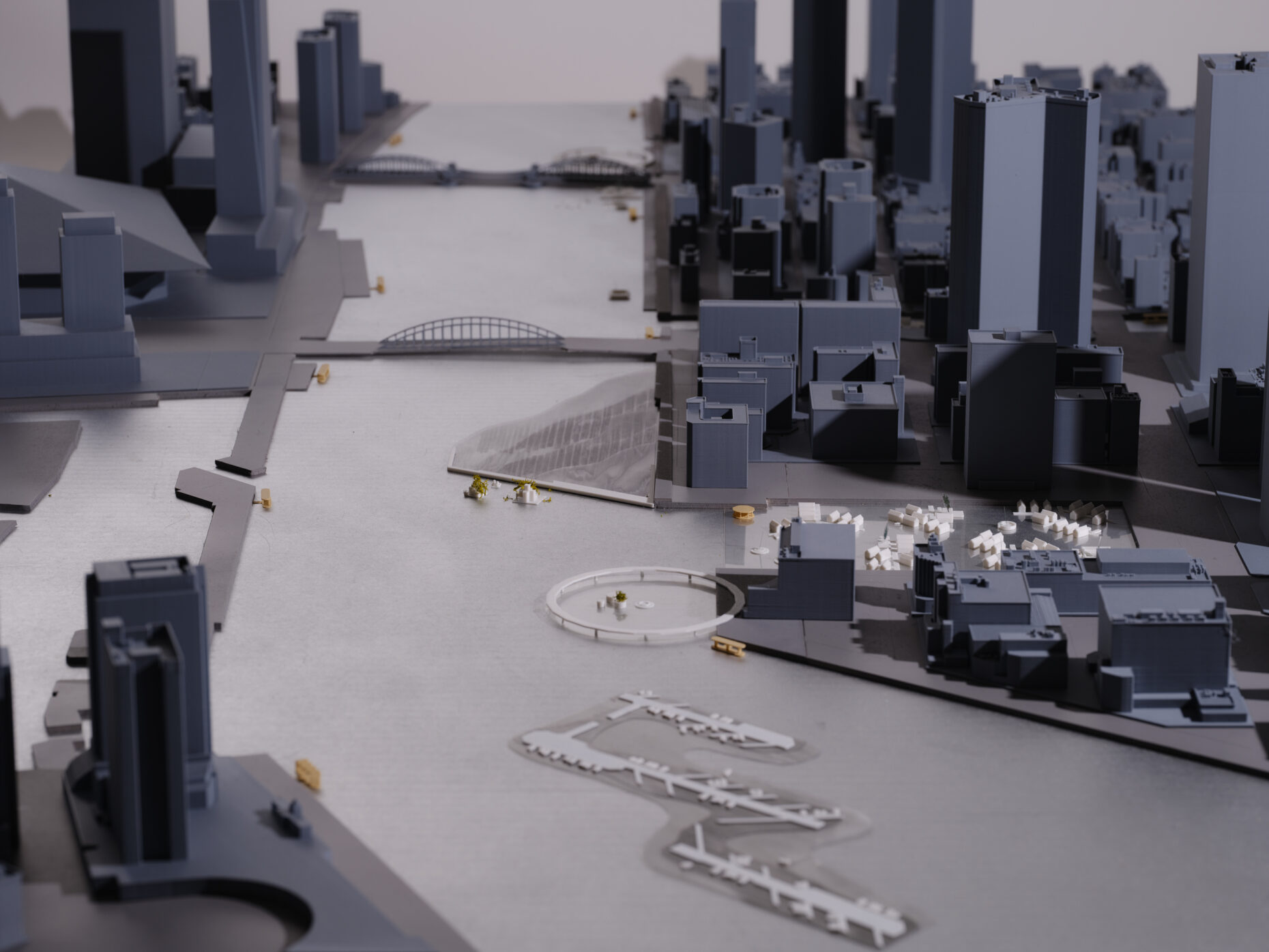
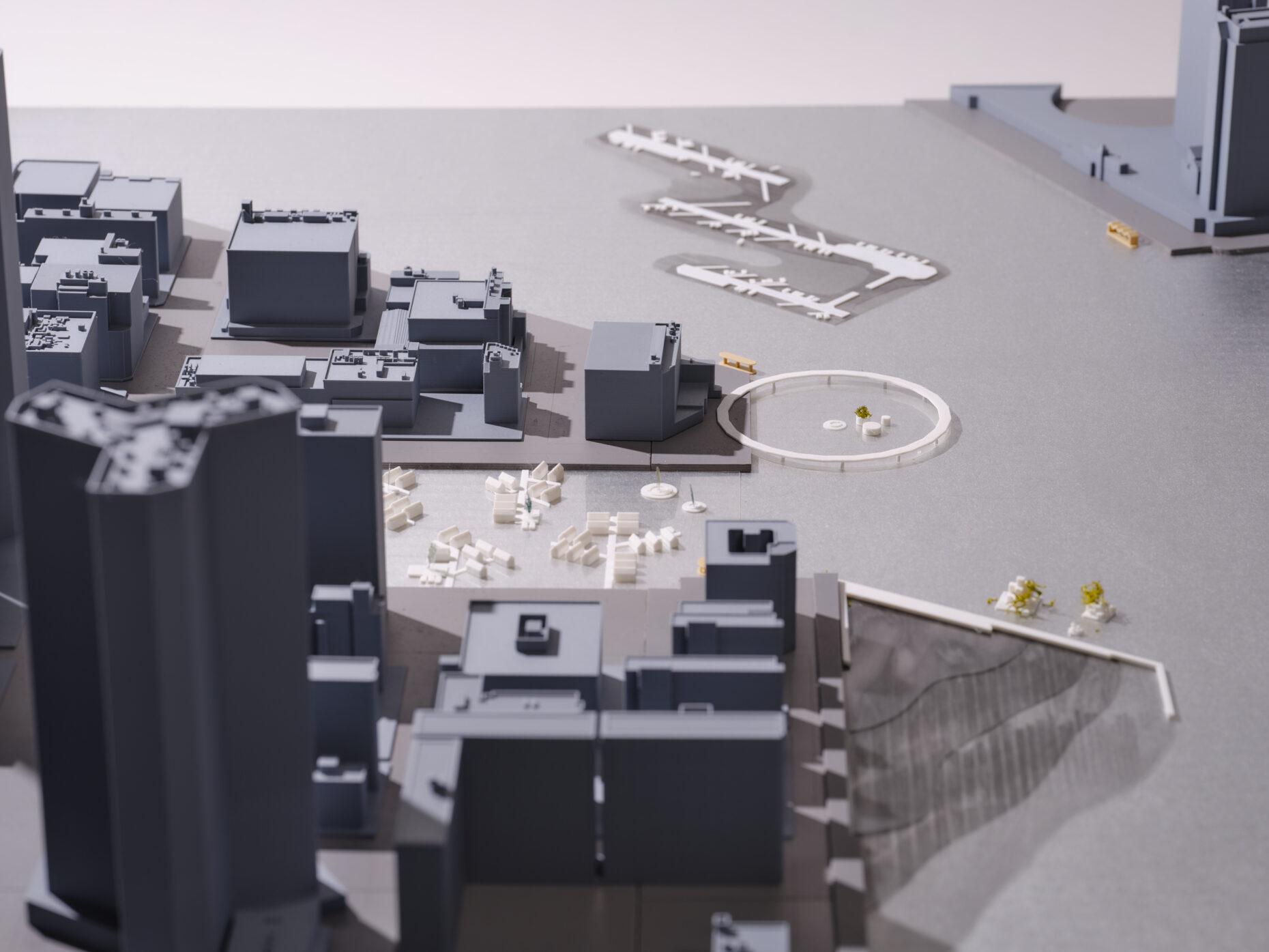
Based on three alternative scenarios for Tokyo Bay, we devised several alternative visions for the Tokyo Bay area. These visions incorporate ideas gleaned from research and fieldwork, revealing numerous practical elements and suggestions for improvement. Our aim is to apply these as architectural proposals to actual sites, ultimately connecting them to an image of the Tokyo Bay area in 2050.
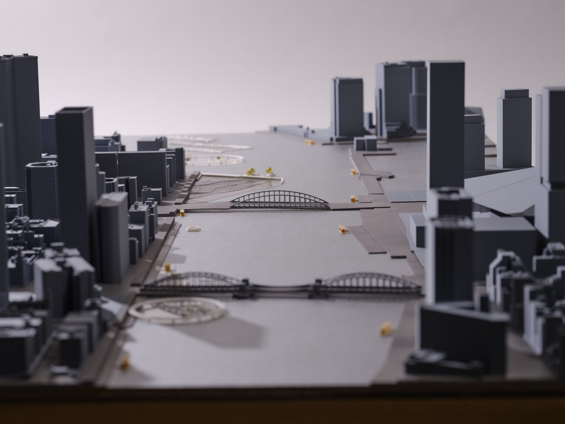
Infinite Pontoon
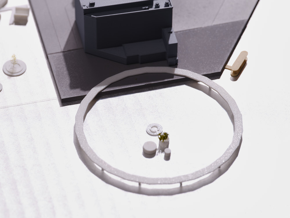
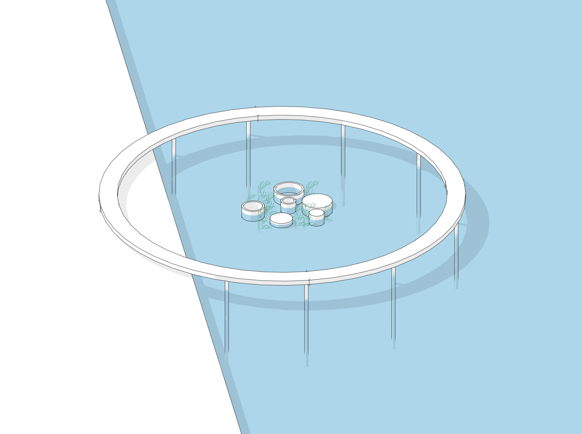
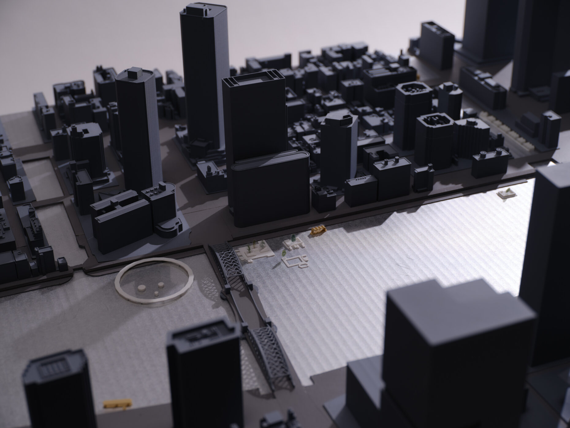
The Infinite Pontoon is a circular pier, approximately 2.5 km in circumference. It can be used as a running or walking course. In Tokyo, it's difficult to feel close to the sea, but having a place where you can venture out a little into the water would bring everyday life much closer to the ocean.
Floating Garden
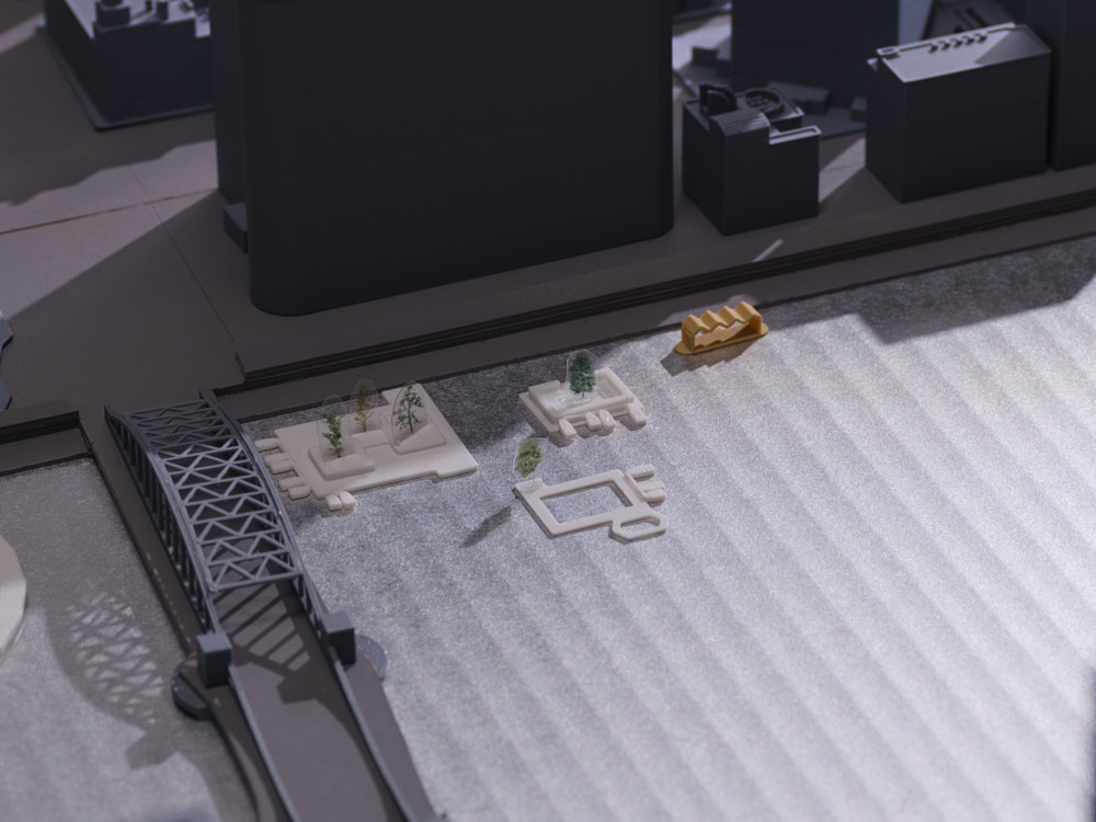
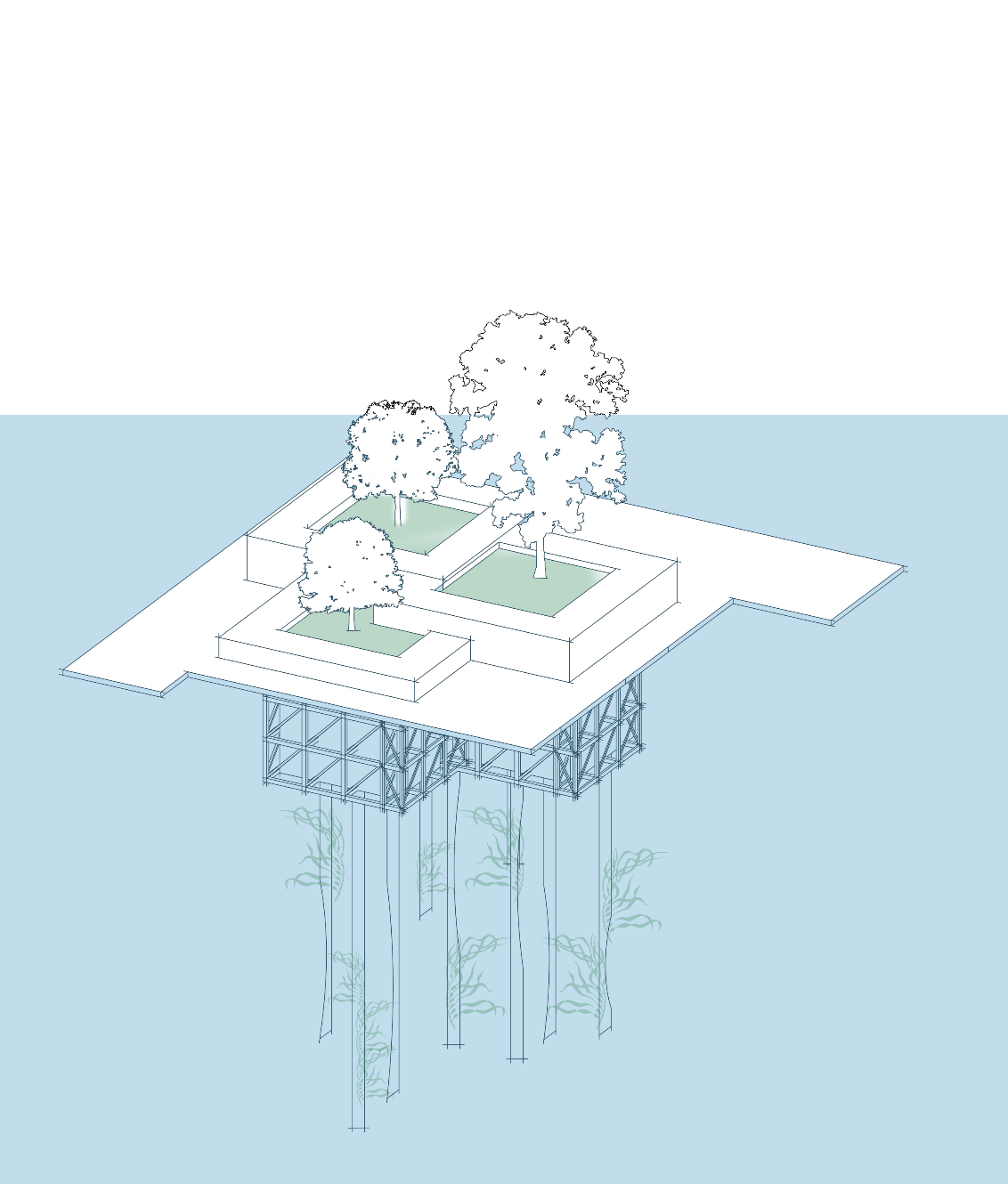
A floating garden is a modern version of a public square, which could also be called a garden on water, or a floating public square. The plaza that once stood at the foot of the Kachidoki Bridge as a firebreak is no longer needed, and the lively culture associated with the bridge has been lost. However, this modern version of a public square allows for immediate and effective space creation, unconstrained by current urban planning.
Because it floats on the sea, it receives plenty of sunlight, and you can catch glimpses of people relaxing on the bridge. Near the river mouth, freshwater and saltwater mix, so it may be possible to cultivate plants suited to the environment (such as mangroves). Furthermore, by designing the floating structure to make it easier for organisms to attach and make it a habitat, it may be possible to promote the growth of seaweed and oysters, and coexist with the blue carbon ecosystem.
Floating Sunken Garden
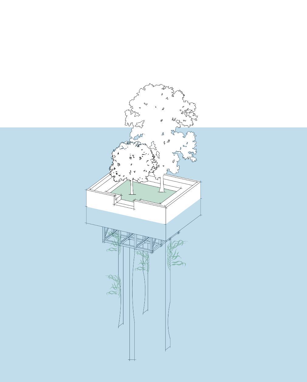
The floating sunken garden has a floor set lower than the water surface, creating a plaza where eye level is close to the water's surface. While functioning similarly to a floating garden, it offers the experience of viewing from a height not usually considered, making it an enjoyable, extraordinary floating plaza. It also serves as an installation device that raises awareness of rising water levels due to global warming.
Floating Reef
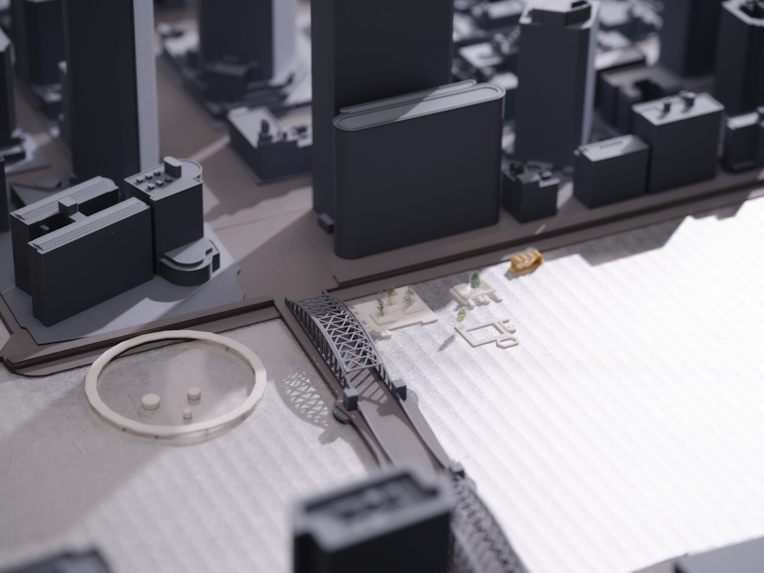
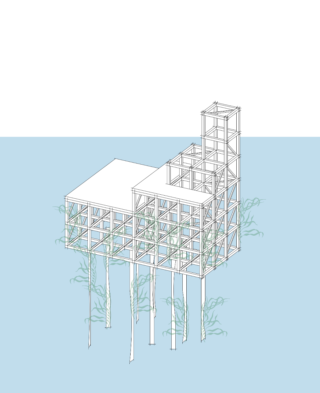
Floating reefs are floating seaweed beds that can be expanded in a modular system from deep water to the surface. They are environmentally resilient structures that various organisms can use as footholds, aiming to contribute to a blue carbon ecosystem. Furthermore, if the underwater portion is designed as an artificial reef, it can serve as a spawning ground and hiding place for small marine organisms, and by altering currents and stirring up plankton, it can promote the growth of surrounding fish. This allows for designs that are highly compatible with human economic activities and fisheries.
Floating Pool
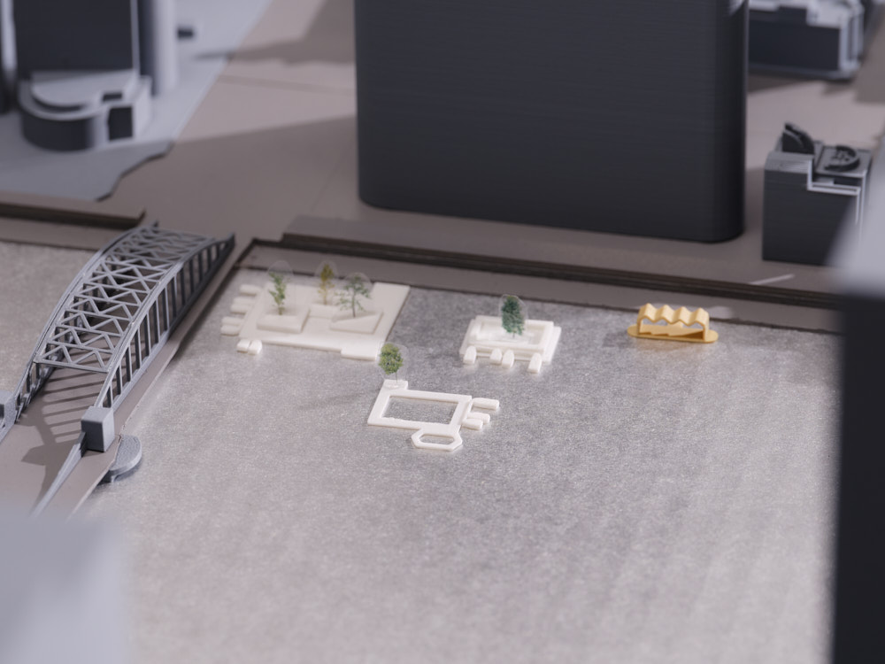
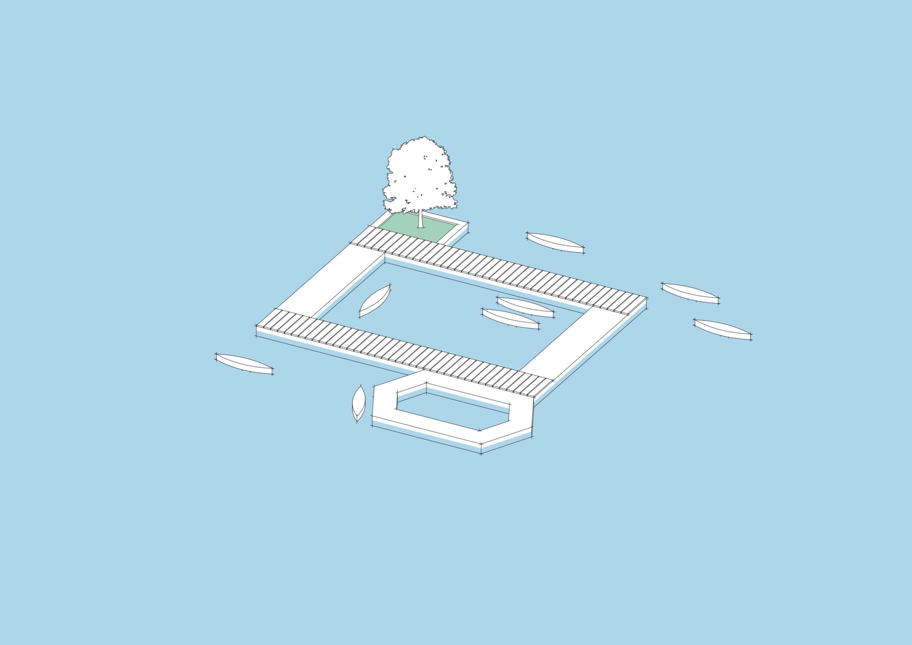
This floating pool offers activities for city dwellers. Accessible by boat, it provides a liberating and open space for recreation.
Floating Houses
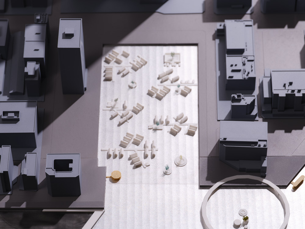
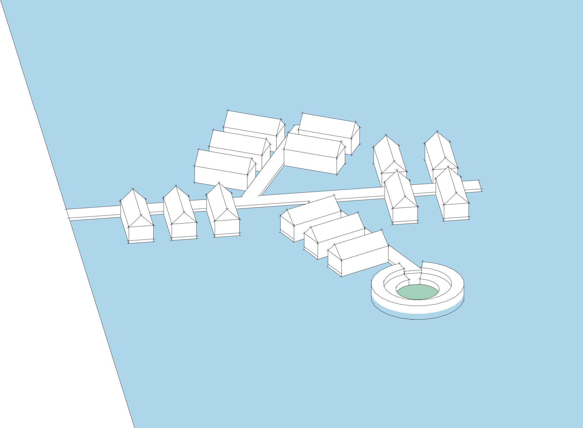
Floating dwellings are already common in Europe and North America. In societies that institutionalize and accept mooring and residential areas for people living on the water, daily life and the maintenance and management of water quality and ecosystems become inextricably linked. In mooring areas, residents themselves routinely monitor water quality and collect garbage, giving rise to a "waterfront maintenance culture by floating dwellers," similar to that of London's Regent's Canal. By establishing this as a living infrastructure rather than being government-led, a common understanding can be fostered between supporting floating dwellings as an urban policy and residents' water quality improvement activities, potentially leading to improved water quality in Tokyo Bay and the formation of a sense of self-awareness as a "city of the sea."
Floating Bus Stop
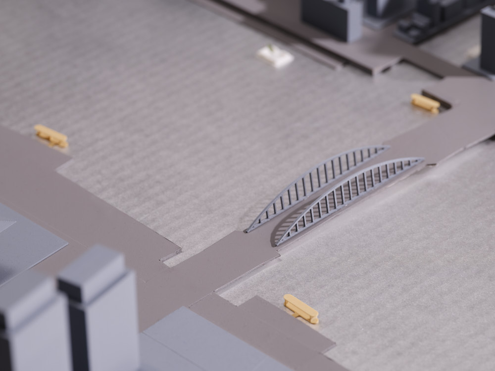
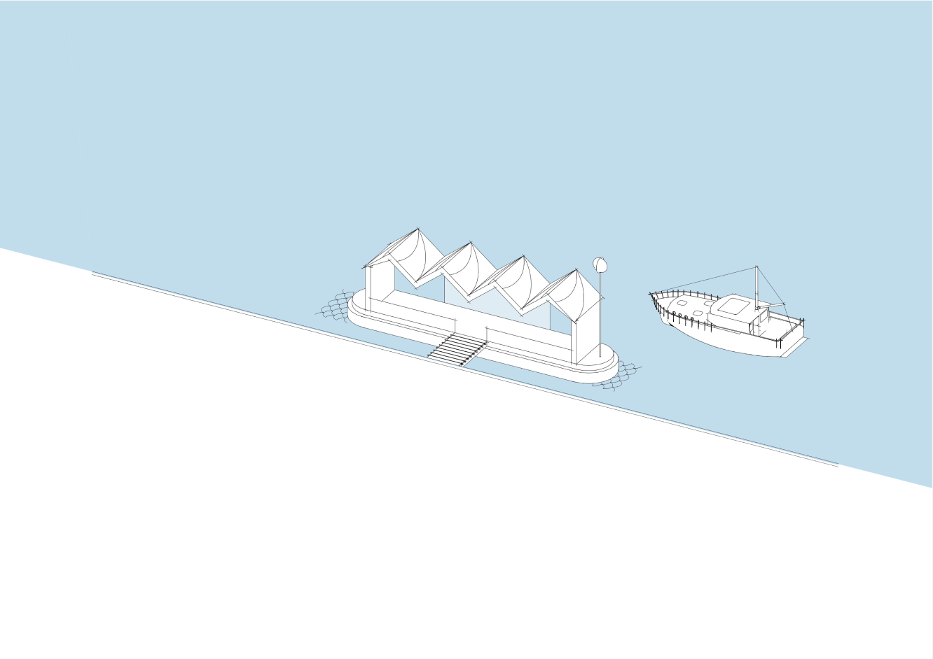
While the former Tsukiji Market is transforming into a large-scale complex centered around an arena, the Kachidoki Bay Area on the opposite shore is mainly residential, and the waterfront promenade is not as lively as expected due to the shade cast by high-rise buildings. By developing environmentally friendly artificial tidal flats and small-scale, human-scale commercial and residential facilities in conjunction with the Tsukiji redevelopment, both shores could form a richer waterfront. At that time, the now-defunct "Kachidoki Ferry" could be revived, and water buses, taxi boats, and tourist gondolas could travel between them, creating a Tokyo Bay water transport network (tentatively named "Sea Loop"), with a series of floating bus stops creating a new urban face.
Protected Nagisa
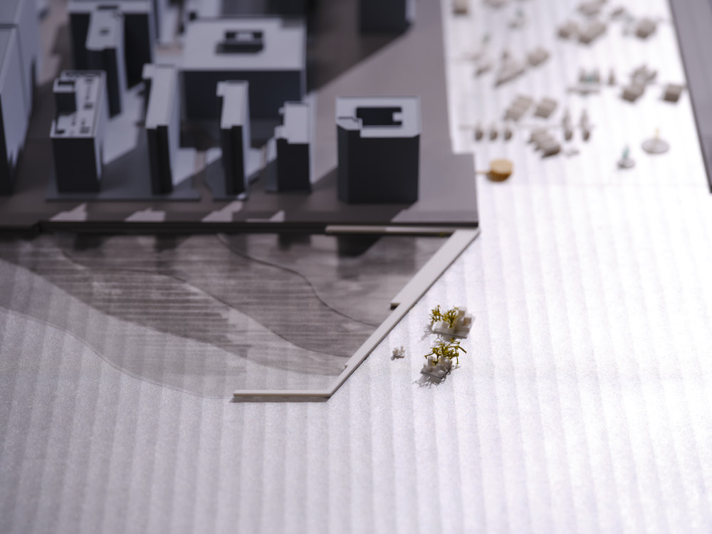
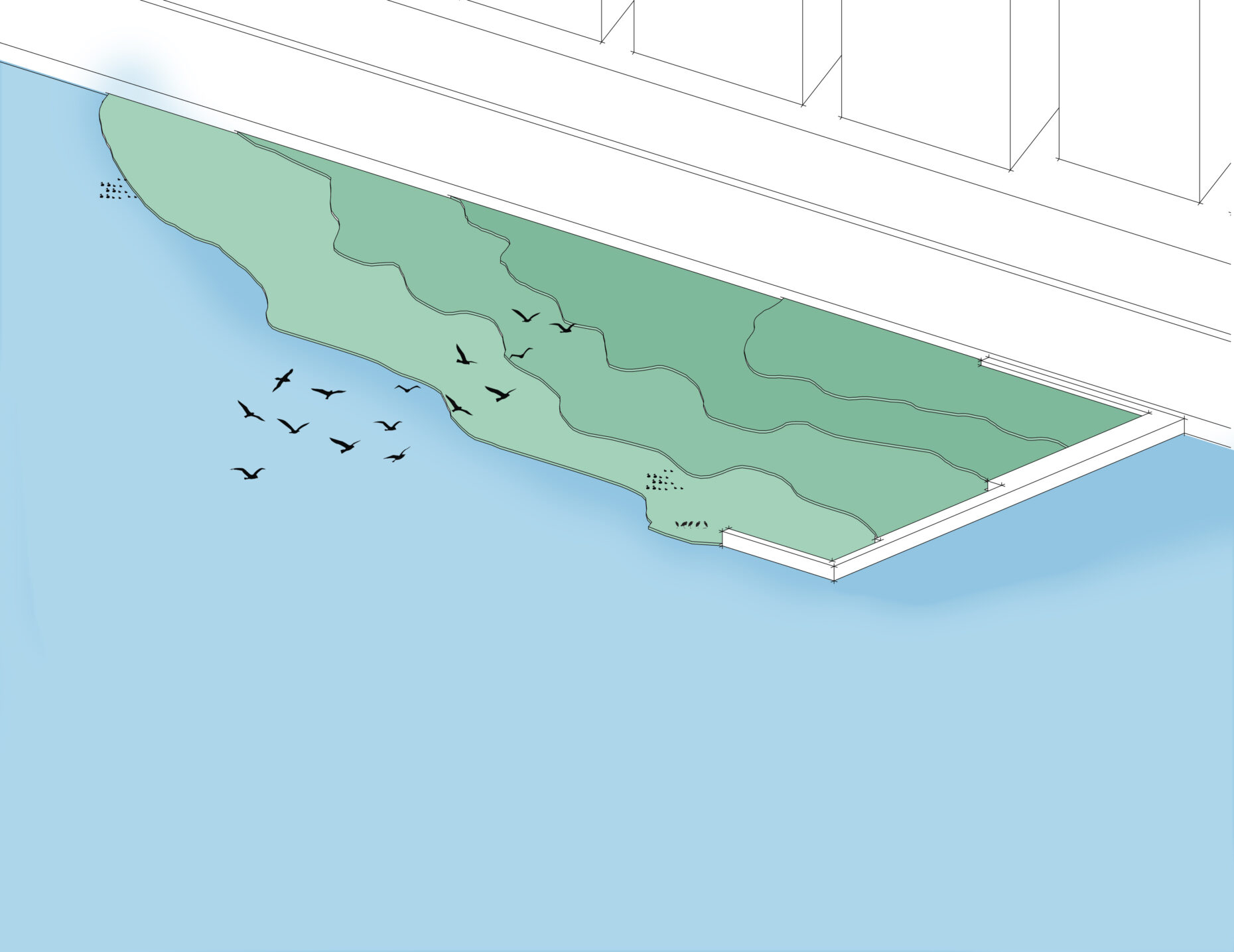
This is an artificial tidal flat developed as an urban aquatic ecosystem. While designation under the Ramsar Convention may be difficult due to the area's active trade, creating it as a nature reserve inaccessible to humans will preserve natural buffer zones such as shallows and reed beds, allowing it to function as a natural green space within the city. In addition to maintaining habitats for birds and fish, its sequential placement with the aforementioned floating gardens and floating reefs will evolve into a structure that allows for continuous habitation of waterfowl, insects, and algae. As a result, the shoreline of Tokyo Bay will not be a razor-sharp breakwater type, but will have a gently sloping topographic cross-section that responds to the ebb and flow of the tides, increasing ecological connectivity.
Loading Bay
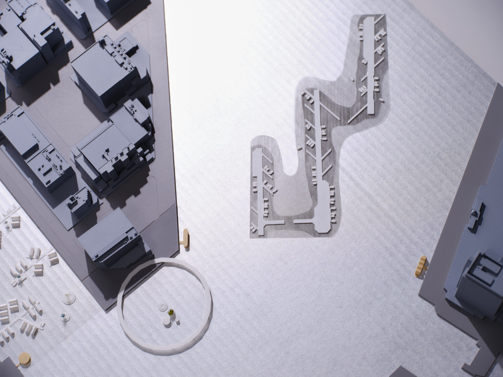
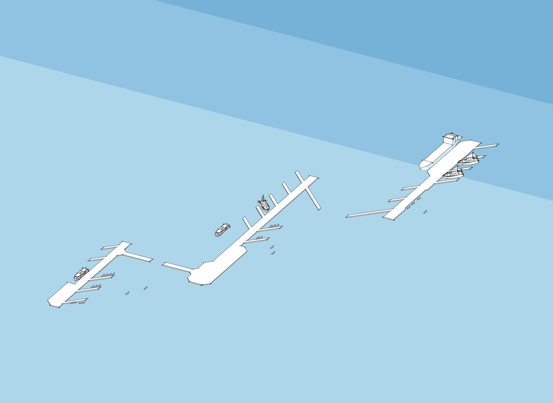
Loading bays (unloading areas and wharves) are essential for creating rich bay areas and shorelines. Their role has evolved over time, from historical port facilities to modern cargo transport and tourist/transportation piers. Like London's Thames, they serve as a transit point where large cargo ships can dock and transfer cargo to smaller vessels, allowing for the maintenance of a "water city" that balances architectural features with ecosystem conservation. In Tokyo Bay, dredging has been repeatedly carried out for maritime logistics, and the resulting soil has been used for land reclamation. However, if left unattended, dredged soil becomes industrial waste, posing challenges in its disposal and resource utilization.
By establishing loading bays at the boundary between the sea and rivers, it becomes possible to reduce dredging volume and preserve water quality and ecosystems. Furthermore, it would dramatically expand the possibilities for creating vibrant bay areas and developing waterfront spaces through the use of small relay vessels, increased employment, and more flexible shoreline design.
Towards a change in the coastline
If the government institutionalizes water-dwellers as "coexisting residents" rather than "excluding" them, the Tokyo Bay area could transform from a "city that expands its land area" to a "city where people live by the water." In this case, the coastline would change from the actual straight coastline to a "water-based, symbiotic coastline." The rigid line created by seawall blocks would be replaced by a variable line created by inlets, decks, and floating structures, and the conventional bay, where the sea recedes due to land reclamation, would see its use on the water surface expanded by floating piers and moored dwellings. Urban planning that prioritized ports and logistics would evolve into a multi-layered waterfront where residence, interaction, fishing, and logistics coexist, and a waterfront living area would be formed with floating markets, pier shops, and cafes scattered throughout.
As a result, the bay area will not be homogeneous and linear, but rather a "breathing coastline where peninsulas and inlets alternate." Furthermore, activities are envisioned that stem from an awareness of being a "city of the sea" and a "city of water," such as community-led cleanup activities, natural purification by plants and aquatic life on floats, and places to learn with the sea through the development of educational and tourism resources.
Unlike traditional cities where land pushes aside the sea to create a defined boundary, this urban structure, which is closely connected to the sea, has the potential to create Tokyo as a "fluid urban ecosystem" where land and sea blend together, blurring the boundaries between them through human life.

Text & Edit: OSO Research (Shogo Onodera, Ayaka Suzuki, Daichi Sato, Koji Sasaki, Ichiro Mishima, Chris Thompson)
Edited by: 3710Lab
Photos: Ichiro Mishima